
Search
Remove Ads
Advertisement
Search Results

Image
Map of the Spanish Colonial Empire
This map illustrates the rise and expansion of the Spanish Colonial Empire during the Age of Exploration, from the late 15th to the early 19th century. Emerging after the completion of the Reconquista in 1492 and...

Image
12 Ancient Scripts We Still Cannot Read - Undeciphered Scripts & Lost Languages of the Ancient World
Throughout history, writing and other recording systems allowed societies to preserve information about administration, trade, religion, and political life. Many...

Curriculum Collection
AP World History Unit 3 - Land-Based Empires (c. 1450–1750)
Between 1450 and 1750 CE, rulers across Eurasia built land empires on a scale not seen before, using gunpowder weaponry to conquer and intricate bureaucracies to govern. The Ottomans took Constantinople...

Collection
Food in the Ancient World
Meals in the ancient Mediterranean revolved around the common staples of cereals, vegetables, fruit, and olive oil, with an occasional bit of fish and meat thrown in for those who could afford it. The Phoenicians and Greeks...

Image
Map of Spanish Conquest & Exploration in North America
This map illustrates the expansion of Spanish imperial power following the completion of the Reconquista in 1492 and the voyages of Christopher Columbus (first voyage 1492). Fueled by promises of...

Image
Map of the Trade in the Indian Ocean 15th–16th Centuries - Monsoon Routes, Spice Trade, and European Expansion
Indian Ocean trade in the 15th and 16th centuries connected East Africa, Arabia, Persia, India, Southeast Asia, and China through an extensive maritime...

Image
Map of the Trade Networks of the Roman Empire - Commerce & the Connectivity in the Mediterranean 1-3 c. CE
The prosperity of the Roman Empire (27 BCE-476 CE in the West) rested not only on military power and administration but also on an extensive network of maritime...

Image
Map of the Dutch Commercial Empire, c. 1665 - A Global Network of Commerce, Exploration and Maritime Power
A map of the Dutch commercial empire which reached its height during the Dutch Golden Age (c. 1588-1672), when the Dutch Republic (1588-1795) emerged as one...
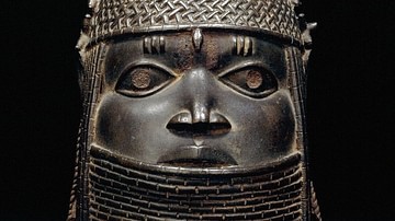
Collection
The Empires of West Africa
The ancient and medieval Mediterranean might have been a bustling stage of ever-changing empires but, across the inhospitable barrier of the Sahara Desert, West Africans were equally busy building up and toppling down...

Image
Map of the East India Company Trade, c.1800
The English East India Company (EIC) was established by Royal Charter on 31 December 1600 under Queen Elizabeth I (reign 1558–1603), granting it a monopoly on English trade east of the Cape of Good Hope...
