
Server Costs Fundraiser 2026


The Indian Ocean trade network of the 15th and 16th centuries formed one of the most extensive and dynamic systems of exchange in the premodern world, linking East Africa, the Middle East, South Asia, and Southeast Asia. This maritime system facilitated the circulation of spices, textiles, metals, timber, and luxury goods, sustained by long-established commercial traditions dominated by Arab, Persian, Indian, and Southeast Asian merchants. Key port cities such as Calicut, Malacca, Hormuz, and Aden functioned as major nodes of redistribution and cultural interaction. The system was further shaped by regional powers, including the Ottoman Empire, whose rulers Mehmed II (reign 1451–1481) and Suleiman the Magnificent (reign 1520–1566) controlled key overland and maritime routes through the eastern Mediterranean, Red Sea, and Persian Gulf, linking Indian Ocean commerce with wider Eurasian trade networks.
From the late 15th century, this established system was increasingly challenged by European maritime expansion. The arrival of the Portuguese following Vasco da Gama’s voyage to India marked the beginning of direct European participation in Indian Ocean trade. Through the use of armed fleets, fortified ports, and attempts to control key choke points, the Portuguese sought to impose monopolies over high-value commodities, especially spices. They were later joined by other European powers, including the Spanish and the Dutch, whose commercial and military strategies gradually altered existing patterns of exchange.
About the Author

Related Images

Portuguese Macao Map
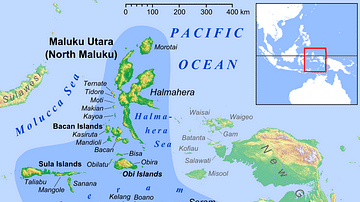
Maluku Islands in Indonesia

Map of Cochin

Map of the Portuguese Commercial Empire, c. 1580 - Fortified Ports, Maritime Trade Routes, and Global Sea Power
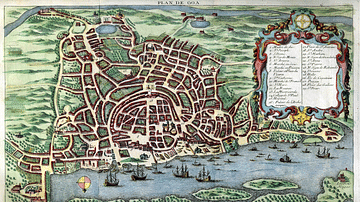
Map of Goa, c. 1750

Map of the Ottoman Empire under Suleiman the Magnificent
Cite This Work
APA Style
Netchev, S. (2025, March 12). Map of the Trade in the Indian Ocean 15th-16th century: From Afro-Asian Exchange to European Intervention. World History Encyclopedia. https://www.worldhistory.org/image/20178/map-of-the-trade-in-the-indian-ocean-15th-16th-cen/
Chicago Style
Netchev, Simeon. "Map of the Trade in the Indian Ocean 15th-16th century: From Afro-Asian Exchange to European Intervention." World History Encyclopedia, March 12, 2025. https://www.worldhistory.org/image/20178/map-of-the-trade-in-the-indian-ocean-15th-16th-cen/.
MLA Style
Netchev, Simeon. "Map of the Trade in the Indian Ocean 15th-16th century: From Afro-Asian Exchange to European Intervention." World History Encyclopedia, 12 Mar 2025, https://www.worldhistory.org/image/20178/map-of-the-trade-in-the-indian-ocean-15th-16th-cen/.