

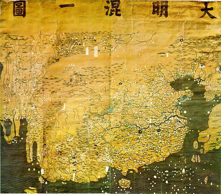
Da Ming Hunyi Tu

The Da Ming Hunyi Tu is a Chinese world map made c. 1389, during the Ming Dynasty. The map, which replicates the curvature of the Earth, centers on China but also includes Africa and Europe. 386 (151.9 in) x 456 cm (175.9). Paint on silk. First Historical Archive of China, Beijing.