


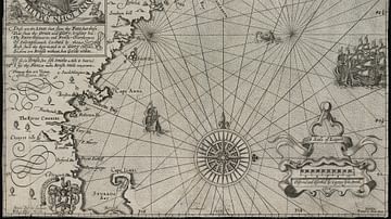
A 1635 CE map of southern Africa by Willem Janszoon Blaeu. It shows the kingdom of Monomotapa (aka Mutapa), although it inaccurately shows the kingdom's spread over a far larger area than it actually controlled around the Zambezi River.
Related Images

Map of Odysseus’ 10-year Journey Home
Map of New England

Map of the World in the 14th Century

Map of the World Known to Europeans in 1000 CE

Map of Ancient & Medieval Sub-Saharan African States

Map of the World of Homer’s Iliad, c. 1200 BCE - The Aegean Bronze Age and the Epic World Around Troy
Cite This Work
APA Style
Blaeu, W. J. (2019, March 18). Map of Mutapa. World History Encyclopedia. https://www.worldhistory.org/image/10251/map-of-mutapa/
Chicago Style
Blaeu, Willem Janszoon. "Map of Mutapa." World History Encyclopedia, March 18, 2019. https://www.worldhistory.org/image/10251/map-of-mutapa/.
MLA Style
Blaeu, Willem Janszoon. "Map of Mutapa." World History Encyclopedia, 18 Mar 2019, https://www.worldhistory.org/image/10251/map-of-mutapa/.