


The Hereford Mappa Mundi is a world map dating to c. 1300. It is the largest surviving Medieval map, and is based on earlier maps including the 8th Century Beatus Map. The map is attributed to "Richard of Haldingham and Lafford", also known as "Richard de Bello".
Ink on vellum. 158 cm x 133 cm, approx. 130 cm (52 in). Located in Hereford Cathedral in Hereford, England.
Related Images

Peutinger Table segments I and II
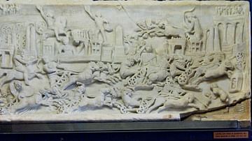
Roman Quadriga Race in the Circus Maximus

Flavius Anastasius Probus
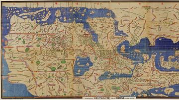
Tabula Rogeriana

Babylonian Map of the World

Detail of the Tabula Peutingeriana
Cite This Work
APA Style
Torana. (2021, May 30). Hereford Mappa Mundi. World History Encyclopedia. https://www.worldhistory.org/image/14125/hereford-mappa-mundi/
Chicago Style
Torana. "Hereford Mappa Mundi." World History Encyclopedia, May 30, 2021. https://www.worldhistory.org/image/14125/hereford-mappa-mundi/.
MLA Style
Torana. "Hereford Mappa Mundi." World History Encyclopedia, 30 May 2021, https://www.worldhistory.org/image/14125/hereford-mappa-mundi/.