
Browse Content
Image
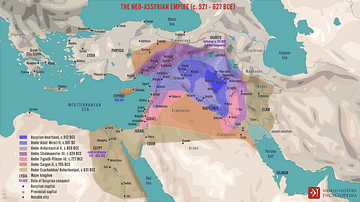
The Neo-Assyrian Empire (c. 921 - 627 BCE)
A map illustrating the rise and expansion of the Neo-Assyrian Empire...
Image
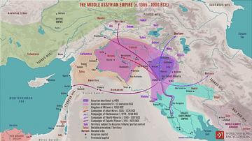
The Middle Assyrian Empire (c. 1365 - 1000 BCE)
A map illustrating the political situation in the Ancient Near...
Image
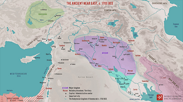
The Ancient Near East, c. 1700 BCE
A map illustrating the political situation in the Ancient Near...
Image
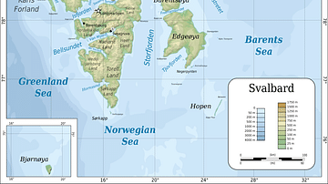
Topographic map of Svalbard
Topographic map of Svalbard archipelago (formerly known as Spitsbergen...
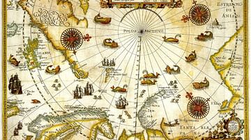
Image
1598 Map of the Three Arctic Voyages (1594–1596) by Willem Barentsz
1598 Map of the Three Arctic Voyages (1594–1596) by Willem Barentsz...
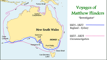
Image
Map of the Voyages of Matthew Flinders in the Investigator
Map showing the circumnavigation of New Holland (Australia) in...