
Browse Content

Image
Map of the Kingdom of the Vandals (435–534 CE)
The Kingdom of the Vandals and Alans (435–534 CE) emerged as one of the most significant post-Roman states...

Image Gallery
10 Maps of Roman Provinces
This gallery of maps highlights the diversity of the Roman Empire by exploring its administrative structure. Roman provinces...

Image
Map of Roman Gaul from Conquest to Integration, c. 200 CE - Provincial Order and Frontier Power in the Roman West
The Roman incorporation of Gaul began with the campaigns...
Image
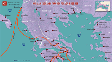
Hadrian's Journey through Achaea, 123-125
This map illustrates the Roman Emperor Hadrian’s journey through Achaea (123–125 CE). It was a significant...

Image
Roman Province Bithynia et Pontus c. 200 CE
The Roman province of Bithynia et Pontus, established in 63 BCE after the defeat of Mithridates VI of Pontus...
Image
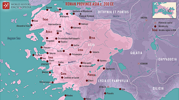
Roman Province Asia c. 200 CE
This map illustrates the Roman province of Asia around 200 CE. Established in 129 BCE following the bequest of the...
