
Browse Content
Image
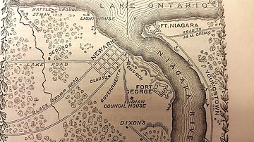
Map of Fort George, c. 1812
Map of Fort George and surrounding areas during the War of 1812, from The Pictorial Field Book of the War of 1812 by...

Image
Map of the Roman Rule in the Levant, c. 200 CE
The Roman Levant around 200 CE, during the height of imperial consolidation under the Severan dynasty...
Image
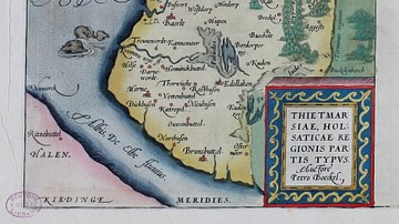
16-century Map of Dithmarshen
Dithmarschen in the Theatrum Orbis Terrarum by Abraham Ortelius, 1570

Image
Map of the U.S. Presidential Election of 1800
This map illustrates the fiercely contested U.S. presidential election of 1800, pitting Federalist incumbent...

Image
Map of the Louisiana Purchase
This map illustrates the geo-political situation in North America after The Louisiana Purchase - the 1803 acquisition...

Image
Totalitarian Regimes in Europe in 1939
This map illustrates the geopolitical situation in Europe in the lead-up to the Second World War (1939-45) as...
