
Browse Content

Image
Map of the Trade in the Indian Ocean 15th-16th century - From Afro-Asian Exchange to European Intervention
The Indian Ocean trade network of the 15th and 16th centuries...

Image
Cities Founded or Renamed in Hadrian’s Name (117 -138 CE)
During the reign of Emperor Hadrian (reigned 117–138 CE), urban patronage became a central tool...
Image
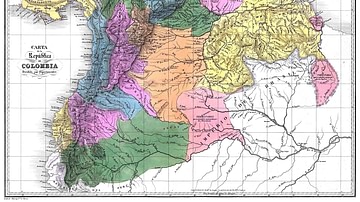
Map of Gran Colombia
A map of the Republic of Colombia (1819-1831), a state that covered much of northern South America after independence from...

Image
Map of Thor Heyerdahl’s Kon-Tiki Expedition, 1947
The Kon-Tiki Expedition (1947) was an experimental voyage led by Norwegian explorer Thor Heyerdahl...
Image
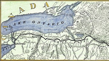
Map of Erie Canal
A map of Erie Canal c. 1840. The canal, constructed between 1817 and 1825, stretches 363 miles (584 km) from the Hudson River...

Image
Possible Agricultural Centers in Prehistoric China
Map showing the spatial distribution of rice, millet, and mixed farming sites with a boundary of rice...
