
Browse Content
Image
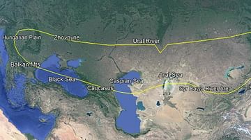
Scythian Territory
A Google Earth image of the Scythian territorial expanse. Google...
Image
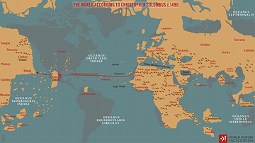
The World According to Columbus c. 1490
A map illustrating Christopher Columbus’s image of the world before...
Image
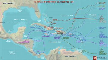
The Voyages of Christopher Columbus 1492-1504
A map illustrating the four voyages to the Americas of Christopher...
Image
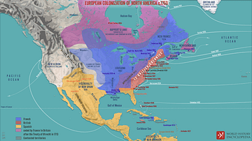
European Colonization of North America c.1750
A map illustrating the process of systematic European colonization...
Image
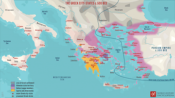
The Greek City-states c. 500 BCE
A map illustrating the city-states of Classical Greece around 500...

Image
Juan Fernández Islands
A map of the Juan Fernández Islands in the eastern Pacific Ocean...