
Browse Content
Image
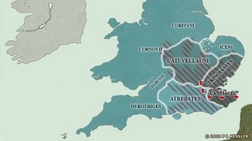
Map of the British Isles in 54 BC
When Julius Caesar landed on the Kent coast in 55 BC, he had a basic knowledge of what to expect of the south-eastern...

Image
Map of Alexander the Great's Conquests
A map showing the route that Alexander the Great took to conquer Egypt, Mesopotamia, Persia, and Bactria.

Image
The Bantu Migration in Africa
A map illustrating the general route of the Bantu migration which occurred in various stages from the second millennium...

Image
Late Medieval Land & Maritime Trade Routes
A map showing the late medieval trade routes by land and sea across Europe and Western Asia.
Image
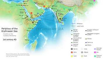
Ancient Indian Maritime Trade Routes
This map is derived from the book Periplus of the Erythraean Sea. It depicts trade routes in the ancient world...

Image
Map of Ancient & Medieval Sub-Saharan African States
A map indicating the major ancient and medieval states in sub-Saharan Africa. Areas and dates relate...
