
Browse Content

Image
Map of the Crusader States, 1229-1240 CE
A map indicating the territories controlled by the Crusader States or Latin East from 1229 CE to 1240 CE after...

Image
Map of the Greenland-Vinland Voyage
Map showing the reconstructed route Norse Vikings sailed in the Vinland sagas on their way to Vinland (Newfoundland...
Image
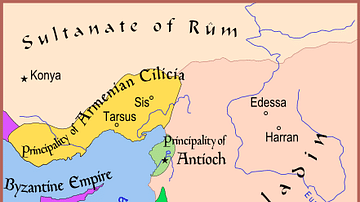
Map of The Latin East, 1190 CE
A map of the Middle East showing the Crusader-held Latin East states at the time of the Third Crusade (1189-1192 CE...

Image
Map of Ancient Egypt, 1746 CE
This map of Egypt with information from ancient times is labeled in Latin. It shows the course of the Nile from Ancient...
Image
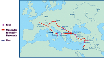
Map of the First Crusade Routes
"This map shows the main routes taken by those who joined the First Crusade. The appeal was made by Pope Urban II...

Image
Map of Mount Athos Monasteries
A map of the monasteries on the Mount Athos peninsula, northern Greece. The first monastery was founded probably...
