


A Google Earth image of the Scythian territorial expanse.
Google Earth (Data: SIO, NOAA, U.S. Navy, NGA, GEBCO, Image: Landsat / Copernicus)
Related Images

Map of the Scythian Expanse, c. 700-300 BCE

Scythians Shooting with Bows
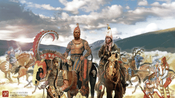
Scythians
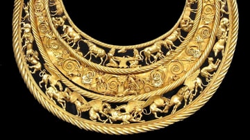
Scythian Golden Pectoral from Tovsta Mohyla

Scythian Golden Man

Scythian Noblewomen, 4th-3rd Century BCE
Cite This Work
APA Style
Copernicus), G. E. (. S. N. U. N. N. G. I. L. /. (2021, October 04). Scythian Territory. World History Encyclopedia. https://www.worldhistory.org/image/14682/scythian-territory/
Chicago Style
Copernicus), Google Earth (Data: SIO, NOAA, U.S. Navy, NGA, GEBCO, Image: Landsat /. "Scythian Territory." World History Encyclopedia, October 04, 2021. https://www.worldhistory.org/image/14682/scythian-territory/.
MLA Style
Copernicus), Google Earth (Data: SIO, NOAA, U.S. Navy, NGA, GEBCO, Image: Landsat /. "Scythian Territory." World History Encyclopedia, 04 Oct 2021, https://www.worldhistory.org/image/14682/scythian-territory/.