


Map showing the circumnavigation of New Holland (Australia) in 1802-1803 by the British navigator and cartographer Matthew Flinders(1774-1814).
Related Images

Map of the Four Voyages of Christopher Columbus, 1492 - 1504

Map of the Voyages of Christopher Columbus 1492-1504

Map of the Two North American Voyages of Henry Hudson

1598 Map of the Three Arctic Voyages (1594–1596) by Willem Barentsz
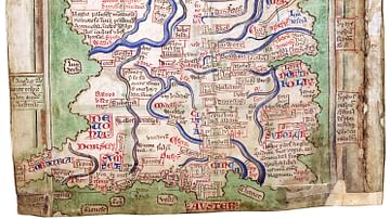
Matthew Paris' Map of Britain

Map of the Scientific Voyages of Edmond Halley (c.1676–1721)
Cite This Work
APA Style
Summerdrought. (2021, December 31). Map of the Voyages of Matthew Flinders in the Investigator. World History Encyclopedia. https://www.worldhistory.org/image/15073/map-of-the-voyages-of-matthew-flinders-in-the-inve/
Chicago Style
Summerdrought. "Map of the Voyages of Matthew Flinders in the Investigator." World History Encyclopedia, December 31, 2021. https://www.worldhistory.org/image/15073/map-of-the-voyages-of-matthew-flinders-in-the-inve/.
MLA Style
Summerdrought. "Map of the Voyages of Matthew Flinders in the Investigator." World History Encyclopedia, 31 Dec 2021, https://www.worldhistory.org/image/15073/map-of-the-voyages-of-matthew-flinders-in-the-inve/.