

 2
2
This text is available in other languages:

The collapse of the Mycenaean palatial system (c. 1200–1100 BCE) initiated a prolonged period of demographic, political, and cultural reorganization across the Aegean. During the Early Iron Age (c. 1100–800 BCE), centralized authority weakened, settlements fragmented or relocated, and populations gradually redistributed across the mainland, Aegean islands, and western Anatolia. Later Hellenic traditions interpreted these developments as migrations of Aeolian, Ionian, Dorian, and Achaean or Arcadian groups, but archaeological evidence suggests uneven processes of mobility, resettlement, interaction, and local continuity rather than single coordinated invasions. In Aeolis, Ionia, Crete, and the Dodecanese, emerging communities combined elements of Mycenaean inheritance with new regional identities and political structures.
By the Archaic period (c. 800–550 BCE), expanding settlement and maritime networks had created a more interconnected Hellenic world centred on the Aegean and western Anatolia. Poleis such as Miletus, Ephesus, and Smyrna became centres of trade, craftsmanship, and cultural exchange, while the development of the polis, the adoption of alphabetic writing (c. 8th century BCE), and the foundation of overseas settlements strengthened connections throughout the Mediterranean and Black Sea. These changes represented both continuity and transformation: older sites, traditions, and trade routes survived, but were reorganized within new institutions and identities. Mobility after the Mycenaean collapse therefore contributed directly to the political, economic, and cultural dynamism of the Archaic Hellenic world.
About the Author
Related Images
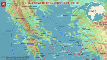
Map of the Aegean Bronze Age Civilizations, c. 3000-1100 BCE - From Minoan Maritime Exchange to Mycenaean Dominance

Achaean League c. 200 BCE
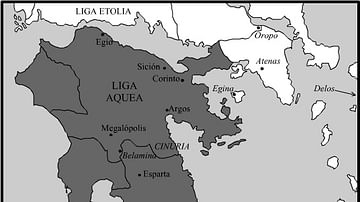
Achaean League c. 150 BCE

Map of the Late Bronze Age Collapse and Transfromation - Interconnected political, economic & environmental breakdown

Bronze Age Gold Bowl, 1100 BCE

Bronze Age Gold Bowl Detail, 1100 BCE
Cite This Work
APA Style
Netchev, S. (2026, July 17). Map of Settlement & Mobility in the Aegean, c. 1100-550 BCE: Migration, Memory, and the Making of the Hellenic World. World History Encyclopedia. https://www.worldhistory.org/image/17921/map-of-settlement--mobility-in-the-aegean-c-1100-5/
Chicago Style
Netchev, Simeon. "Map of Settlement & Mobility in the Aegean, c. 1100-550 BCE: Migration, Memory, and the Making of the Hellenic World." World History Encyclopedia, July 17, 2026. https://www.worldhistory.org/image/17921/map-of-settlement--mobility-in-the-aegean-c-1100-5/.
MLA Style
Netchev, Simeon. "Map of Settlement & Mobility in the Aegean, c. 1100-550 BCE: Migration, Memory, and the Making of the Hellenic World." World History Encyclopedia, 17 Jul 2026, https://www.worldhistory.org/image/17921/map-of-settlement--mobility-in-the-aegean-c-1100-5/.
