
Search
Did you mean: Bes?
Remove Ads
Advertisement
Search Results

Image
North Africa After the Berber Revolt (739-743 CE)
Northwest Africa after 743 CE, when the Umayyad Caliphate had been overthrown in the region by the Berber Revolt of 739 - 743 CE.

Image
Trade in the Roman Empire Map (c. 200 CE)
This map shows the major sources of trade goods in the Roman Empire, circa 200 CE. The map shows the sources of the following trade goods: grain, olive oil, slaves, wine, metals, textiles and wild animals.

Image
The Greatest Extent of the Ottoman Empire in Europe (1683 CE)
A depiction of the Ottoman Empire and its dependencies in 1683 CE, with an indication of territory held prior to that date.

Image
Maori Woman Wearing Hei Tiki in 1873 CE
Maori woman of the Aperahama family in Manaia (New Zealand) in 1873 CE wearing a hei tiki.

Image
Gothic Invasion 250-251 CE
Gothic invasion in the Balkans, 250-251 CE, and the battle of Abritus.

Image
The Korean Peninsula and the Japanese Archipelago, 3rd-6th century CE
Map of Pen/Insular states and potential centres in the 3rd–6th centuries CE.
Image
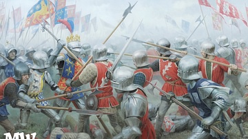
Battle of Barnet (1471 CE)
Illustration of the Battle of Barnet (1471 CE), a decisive battle of the Wars of the Roses, by Graham Turner. Courtesy of Medieval Warfare Magazine / Karwansaray Publishers.

Image
Map of the Holy Roman Empire, 972-1032 CE
Map of the Holy Roman Empire depicting its boundaries under the rule of Otto I in 972 CE and Conrad II in 1032 CE.
Image
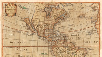
Map of the Americas, 1666 CE
"Americæ descriptio nova", a map of the Americas in 1666 CE. Made by William Trevethen, Philip Chetwind, and Lessing Julius Rosenwald (1891-1979 CE). Published by Impensis Philippi Chetwing. From the Rosenwald Collection...

Image
Patroon & Lady of New Amsterdam, c. 1640 CE
Illustration of a Dutch patroon and lady from New Amsterdam in well-made attire c. 1640 CE. From Historic Dress in America 1607 - 1800 by Elisabeth McClellan. Published in Philadelphia by George W. Jacobs...
