
Search
Did you mean: Bes?
Remove Ads
Advertisement
Search Results

Image
The Spanish Armada of 1588 CE By van Wieringen
A 17th century CE painting by Cornelis Claesz van Wieringen of the Spanish Armada which sailed to invade England in 1588 CE. (Rijksmuseum, Amsterdam)

Image
Second Siege of Vienna 1683 CE
The Second Siege of Vienna in 1683 CE, drawn by Frans Geffels (l. 1624–1694 CE). This was a disastrous Ottoman defeat. (Vienna Museum at Karlsplatz)

Image
18th-century CE Tobacco Paper
Tobacco paper for Sharpe's Best Virginia, at Fleet Street, London, c. 1725-1775 CE.
British Museum, London.
Image
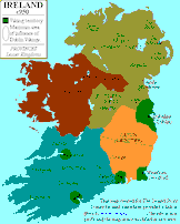
Map of Ireland c. 950 CE
Map of Ireland around 950 CE, showing both the local Irish kingdoms and the Viking territories. Map credited to www.irelandhistory.com

Image
Map of the Byzantine Empire in 1025 CE
Map of the provinces of the Byzantine Empire in 1025 CE.

Image
Massachusetts Two Shilling Bill, 1741 CE
A bill worth two shillings, or a "2s", from the Massachusetts Bay Colony. Collection of the National Numismatic Collection at the Smithsonian Institution.

Image
15th-century CE Ottoman Cannon
A 15th-century CE bronze Ottoman cannon based on the design of those used in the siege of Constantinople in 1453 CE by Mehmed II.
Image
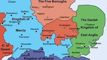
English Midlands c. 912 CE
Map showing the English midlands around 912 CE, including the kingdom of Mercia which was reigned by the renowned Aethelflaed, Lady of the Mercians (r. 911-918 CE) at the time.
Image
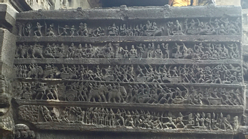
The Armies of the Rashtrakutas (Eighth to Tenth Centuries CE)
This war scene shown in a temple frieze in the Kailashanatha Temple built by the Rashtrakuta emperor Krishna I (756-773 CE) depicts the Mahabharata war. The soldiers' arms and armour however...

Image
Extent of the Teutonic Order c. 1300 CE
A map indicating the commanderies and territories (shaded blue) under the control of the Teutonic Order c. 1300 CE.
