
Search
Did you mean: Bes?
Remove Ads
Advertisement
Search Results

Image
England Around 910 CE
Map showing England around 910 CE, showing among others the Viking territories under the Danelaw as well as the English kingdoms of Mercia (at this point in time ruled by Aethelred, Lord of the Mercians (r. 881-911 CE) and...

Image
Ireland c. 900 CE
Map of Ireland, c. 900 CE.

Image
Political Map of Italy circa 1000 CE
Political map of Italy near the arrival of the Normans, who eventually conquered Southern Italy and Sicily, including the principalities of Salerno, Capua, and Benevento.

Image
Extent of the Teutonic Order c. 1300 CE
A map indicating the commanderies and territories (shaded blue) under the control of the Teutonic Order c. 1300 CE.

Image
The Near East in 1135 CE
This map of the Near East in 1135 CE shows four Crusader States (marked with red crosses) in relation to other powerful kingdoms in the period between the first and second crusades.

Image
Great Viking Army in England, 865-878 CE
Map showing the routes allegedly taken by the Great Viking Army that invaded the Anglo-Saxon Kingdoms in 865 CE, under leadership of such chieftains as 'Hingwar', 'Hubba', and 'Halfdene' (Anglo-Saxon Chronicle...

Image
The Attack on Damietta, 1218 CE
A 13th century CE manuscript illustration depicting the attack on Damietta in Egypt in 1218-19 CE during the Fifth Crusade (1217-1221 CE). (From the Chronica Majorca by Matthew Paris, Corpus Christi College, Cambridge...
Image
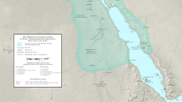
Mamluk Sultanate, 1317 CE
A map indicating the territory of the Mamluk Sultanate based in Cairo, 1317 CE.

Image
Map of the Goryeo Empire (11th century CE)
A map of the territory controlled by the Goryeo Dynasty of Korea in the 11th century CE. The Goryeo reigned from 918 to 1392 CE.
Image
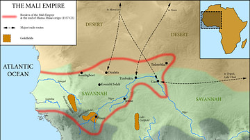
Map of the Mali Empire, c. 1337 CE
A map of the Mali Empire (1240-1645 CE) at its peak c. 1337 CE after the reign of Mansa Musa (1312-1337 CE).
