Server Costs Fundraiser 2024
Help our mission to provide free history education to the world! Please donate and contribute to covering our server costs in 2024. With your support, millions of people learn about history entirely for free every month.
$3890 / $18000
Illustration
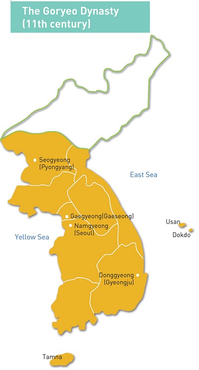
A map of the territory controlled by the Goryeo Dynasty of Korea in the 11th century CE. The Goryeo reigned from 918 to 1392 CE.
Cite This Work
APA Style
Service, K. C. &. I. (2016, September 07). Map of the Goryeo Empire (11th century CE). World History Encyclopedia. Retrieved from https://www.worldhistory.org/image/5609/map-of-the-goryeo-empire-11th-century-ce/
Chicago Style
Service, Korean Culture & Information. "Map of the Goryeo Empire (11th century CE)." World History Encyclopedia. Last modified September 07, 2016. https://www.worldhistory.org/image/5609/map-of-the-goryeo-empire-11th-century-ce/.
MLA Style
Service, Korean Culture & Information. "Map of the Goryeo Empire (11th century CE)." World History Encyclopedia. World History Encyclopedia, 07 Sep 2016. Web. 26 Jul 2024.
