
Server Costs Fundraiser 2026


The westward expansion of the Scythians (c. 700–300 BCE) illustrates how mobile steppe societies could reshape the political and cultural landscapes of Eurasia without building territorial empires. Originating in the Central Asian steppes, Scythian groups moved steadily west into the Pontic–Caspian region, exploiting their mastery of horse-based warfare and flexible social organization. Their mobility allowed them to dominate vast grasslands, control key corridors between Asia and Europe, and intervene decisively in the affairs of settled states along the fringes of the steppe world.
From the Near East to the northern Black Sea, Scythians interacted with major civilizations through warfare, alliance, tribute, and trade. They confronted Assyria during the late Neo-Assyrian period (7th century BCE), engaged with the Achaemenid Persian Empire under rulers such as Darius I (reigned 522–486 BCE), and maintained close, often tense, relations with Greek colonies along the Black Sea coast. Archaeological evidence from richly furnished kurgan burials reveals a stratified society, long-distance exchange networks, and a shared elite culture expressed through weaponry, animal-style art, and goldwork. By the late 4th–3rd centuries BCE, pressure from related nomadic groups, especially the Sarmatians, fragmented Scythian power, yet their legacy endured in classical historiography, steppe traditions, and the long-standing model of mounted nomadic dominance.
Special thanks to Patrick Scott Smith for his research and input.
About the Author

Related Images

Map of the Indo-Saka Kingdoms
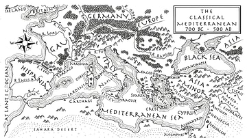
An Illustrated Map of the Mediterranean from 700 BCE to 500 CE (From the Novel "The Jericho River")

Map of the Achaemenid Persian Empire c. 500 BCE

Theogony (Generations of the Gods) by Hesiod, c. 700 BCE

Map of the Migration Period in Europe in the 4th-5th Century

Map of Romani Migration in the Middle Ages
Cite This Work
APA Style
Netchev, S. (2026, January 26). Map of the Scythian Expanse, c. 700-300 BCE. World History Encyclopedia. https://www.worldhistory.org/image/14359/map-of-the-scythian-expanse-c-700-300-bce/
Chicago Style
Netchev, Simeon. "Map of the Scythian Expanse, c. 700-300 BCE." World History Encyclopedia, January 26, 2026. https://www.worldhistory.org/image/14359/map-of-the-scythian-expanse-c-700-300-bce/.
MLA Style
Netchev, Simeon. "Map of the Scythian Expanse, c. 700-300 BCE." World History Encyclopedia, 26 Jan 2026, https://www.worldhistory.org/image/14359/map-of-the-scythian-expanse-c-700-300-bce/.