Cite This Work
APA Style
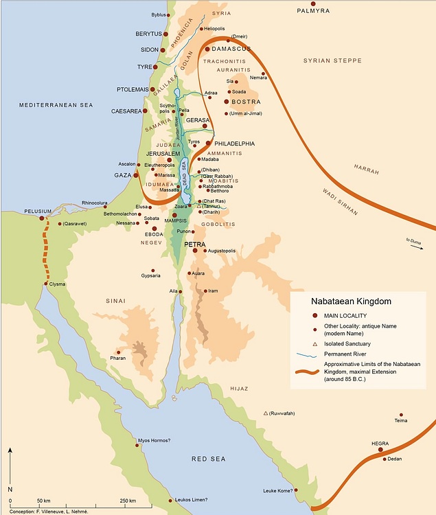
Nehme, V. (2021, March 20). Map of the Nabatean Kingdom. World History Encyclopedia. Retrieved from https://www.worldhistory.org/image/13692/map-of-the-nabatean-kingdom/
Chicago Style
Nehme, Villeneuve. "Map of the Nabatean Kingdom." World History Encyclopedia. Last modified March 20, 2021. https://www.worldhistory.org/image/13692/map-of-the-nabatean-kingdom/.
MLA Style
Nehme, Villeneuve. "Map of the Nabatean Kingdom." World History Encyclopedia. World History Encyclopedia, 20 Mar 2021, https://www.worldhistory.org/image/13692/map-of-the-nabatean-kingdom/. Web. 03 Jul 2025.
