


A map indicating the area controlled by the African kingdom of Axum (1st-8th century CE) on the coast of the Red Sea.
Related Images

Image
Map of the Middle Kingdom of Egypt, c. 2000 BCE
This map illustrates the Middle Kingdom of Egypt (c. 2055–1650...

Image
Map of the New Kingdom Egypt under Ramesses II - Egypt, Nubia, Hittites, and the Late Bronze Age c. 1250 BCE
The New Kingdom of Egypt (c. 1570–1069 BCE) marked the height of...

Image
Map of the Ptolemaic Kingdom of Egypt c. 240 BCE - Power, Wealth, and Rivalry in the Hellenistic World
By c. 240 BCE, Ptolemaic Egypt stood as one of the most powerful...

Image
Map of the Bosporan Kingdom, c.100 CE - Gateway Between Steppe, Caucasus, and Rome
The Bosporan Kingdom (c. 480 BCE–341 CE) emerged around the Cimmerian...
Image
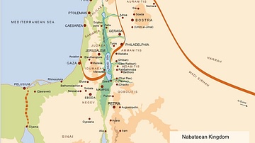
Map of the Nabatean Kingdom
Map of the Nabatean Kingdom at its greatest extent, c. 85 BCE.

Image
Map of the New Kingdom of Egypt, 1450 BCE
A map showing the maximum territorial extent of the New Kingdom...
Cite This Work
APA Style
Yom. (2019, March 21). Map of Kingdom of Axum. World History Encyclopedia. https://www.worldhistory.org/image/10270/map-of-kingdom-of-axum/
Chicago Style
Yom. "Map of Kingdom of Axum." World History Encyclopedia, March 21, 2019. https://www.worldhistory.org/image/10270/map-of-kingdom-of-axum/.
MLA Style
Yom. "Map of Kingdom of Axum." World History Encyclopedia, 21 Mar 2019, https://www.worldhistory.org/image/10270/map-of-kingdom-of-axum/.