
Search
Remove Ads
Advertisement
Search Results

Curriculum Collection
AP World History Unit 2 - Networks of Exchange (c. 1200-1450)
Between 1200 and 1450, the trade networks linking Afro-Eurasia intensified and reached further than ever before. The Silk Roads carried silk, porcelain, and paper westward across Central Asia...
Article
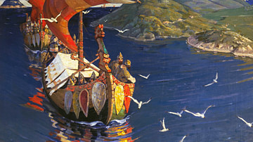
Trade & Warfare in the Kievan Rus
Scandinavians from the island of Gotland began to spread throughout the Baltic region along the Russian rivers in the 700s. While the Vikings of Norway and Denmark from the 8th to 11th centuries are widely recognized...

Image
Map of the Roman Trade with the East, c. 1st–3rd Centuries - Silk Roads and Indian Ocean Routes across Afro-Eurasia
Roman trade with the East refers to the overland and maritime exchange networks that connected the Roman Empire with Parthian Iran, the Kushan Empire...

Image
Map of the Trade Networks in the Middle Ages, c. 1200
By the early 13th century (c. 1200 CE), long-distance trade networks across Eurasia and the Mediterranean had regained a level of interconnectivity not seen since late antiquity. After the political...
Image
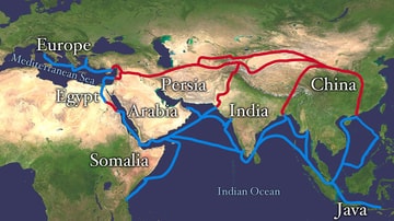
Map of the Silk Road Routes
This map indicates trading routes used around the 1st century CE centred on the Silk Road. The routes remain largely valid for the period 500 BCE to 500 CE.

Image
Map of the African Slave Trade Networks, c. 1750 - Atlantic, Trans-Saharan, Red Sea & Indian Ocean Routes
By c. 1750, the slave trades affecting Africa were entering a period of major transformation. Long-established trans-Saharan, Red Sea, and Indian Ocean networks...

Teaching Material
Phoenician Maritime Trade and Cultural Exchange
This lesson plan has two parts. During the first part, students will watch a video introducing the Phoenicians and answer the questions on Worksheet #1. In the second part, students will participate in...

Image
Map of the Mediterranean Trade Networks, c. 700–350 BCE - Commerce & Colonization in the Archaic and Classical Ages
Between c. 700 and 350 BCE, the Mediterranean formed part of a broad and increasingly interconnected system of maritime and overland exchange linking...

Image
Map of the East India Company Trade, c.1800
The English East India Company (EIC) was established by Royal Charter on 31 December 1600 under Queen Elizabeth I (reign 1558–1603), granting it a monopoly on English trade east of the Cape of Good Hope...

Image
Map of the Hanseatic League Trade Network, c. 1400
The Hanseatic League (c. 13th–17th centuries) was a powerful network of merchant guilds and cities that dominated trade across northern Europe for centuries. Emerging in the late Middle Ages, the League...
