
Search
Remove Ads
Advertisement
Search Results

Image
Military Map of the French Border, Maubeuge to Douai - Campaigns of 1793–1794 With Army Positions
This military map covers the French border region from Maubeuge to Douai and was designed to support the understanding of the campaigns conducted between 1793 and 1794. It details the positions of French and Austrian forces during this phase...
Image
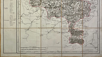
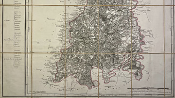
Map of the Jemappes Department
This antique map of Belgium depicts the Jemappes department under the First French Empire. It was created in the early 19th century by French geographer Pierre-Gilles Chanlaire and is included in the Atlas National de France. The map reflects...
Image
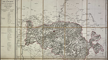
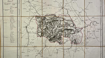
Map of the Ourthe Department
This antique map of Belgium represents the Ourthe department under the First French Empire. It was produced in the early 19th century by French geographer Pierre-Gilles Chanlaire and is part of the Atlas National de France. The map reflects...
Image
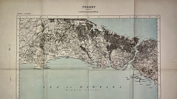
Map of the Surroundings of Constantinople, 1909 - Published by the War Office, United Kingdom
This antique map of Turkey depicts the surroundings of Constantinople (modern-day Istanbul) and was published by the British War Office in 1909. It offers a detailed view of the region at the beginning of the 20th century, reflecting both...
Image
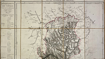
Map of the Genoa Department
This antique map of Italy represents the Genoa department under the First French Empire. It was produced in the early 19th century by French geographer Pierre-Gilles Chanlaire and is part of the Atlas National de France. The map reflects...
Image
Map of the Marengo Department
This antique map of Italy shows the Marengo department under the First French Empire. It was produced in the early 19th century by French geographer Pierre-Gilles Chanlaire and is part of the Atlas National de France. The map reflects the...
Image
Map of the Mont-Tonnerre Department
This antique map of Germany represents the Mont-Tonnerre department under the First French Empire. It was produced in the early 19th century by French geographer Pierre-Gilles Chanlaire and is part of the Atlas National de France. The map...

Image
Map of the Area Around Lille and Courtray - Battle Positions at Tourcoing and Pont-à-Chin
This historical map depicts the surroundings of Lille and Courtray and is intended to facilitate the understanding of the Battles of Tourcoing and Pont-à-Chin in 1794. It shows the positions of the armies involved during these engagements...

Image
Map of the Area Between the Lahn and the Sieg - Military Operations, 14–21 June 1796
This historical map was produced to support the understanding of military operations conducted between the Lahn and Sieg rivers from 14 to 21 June 1796. It provides a geographic overview of the region during this critical phase of the campaign...
Image
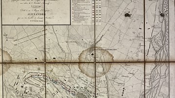
Map of the Battle of Novi
This map presents the Battle of Novi, fought on 15 August 1799 and won by the allied armies of Russia and Austria under the command of Field Marshal Alexander Suvorov. It was dedicated to His Majesty Emperor Alexander by Lieutenant General...