

Map of Roman Rule in Asia Minor, c. 200 CE

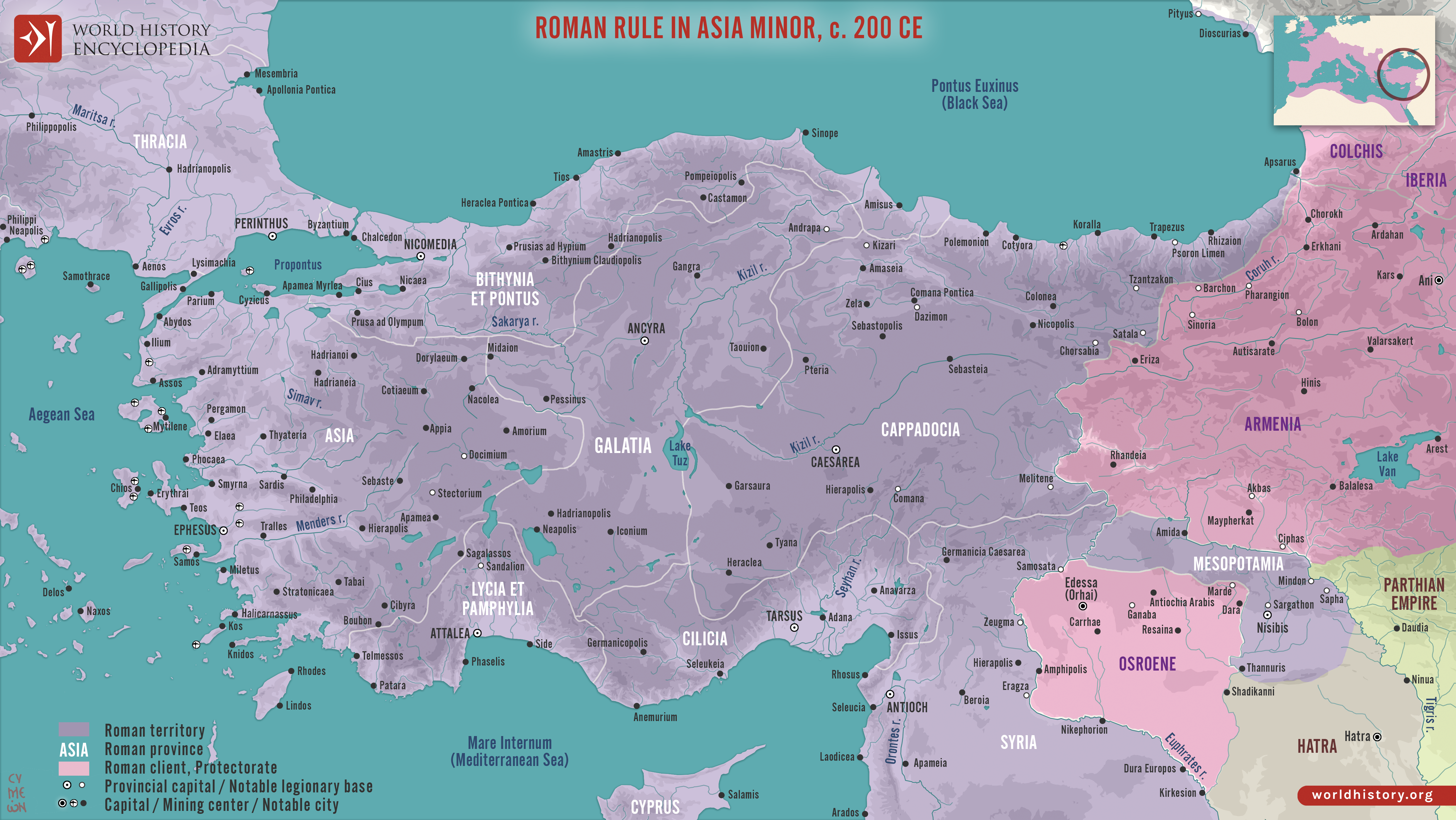
This map illustrates the geopolitical landscape of Asia Minor during the reign of Emperor Septimius Severus (193–211 CE), around the year 200 CE. By this time, the peninsula (modern-day Turkey) had been under Roman rule for more than two centuries, following successive campaigns of the Republic and annexations under the early empire. Asia Minor formed one of the empire’s most prosperous regions, integrated into Roman administration and culture while also serving as a strategic bridge between Europe and the eastern provinces.
Administratively, Asia Minor was divided into several provinces, including Asia, Bithynia et Pontus, Galatia, Cappadocia, Cilicia, and Lycia et Pamphylia, each overseen by Roman governors. Cities such as Ephesus, Pergamon, and Antioch flourished with Roman infrastructure, civic life, and trade, while Latin and Greek cultural influences blended. To the east, client kingdoms like Armenia and Osroene maintained complex, shifting relations with Rome, often serving as buffer states in the ongoing rivalry with Parthia. Although occasional unrest and revolts occurred, the Severan era in Asia Minor was largely a period of stability and prosperity, leaving a deep imprint on the region’s urban, cultural, and political development.