

Map of the Spanish Main & Caribbean Pirate Havens c. 1670

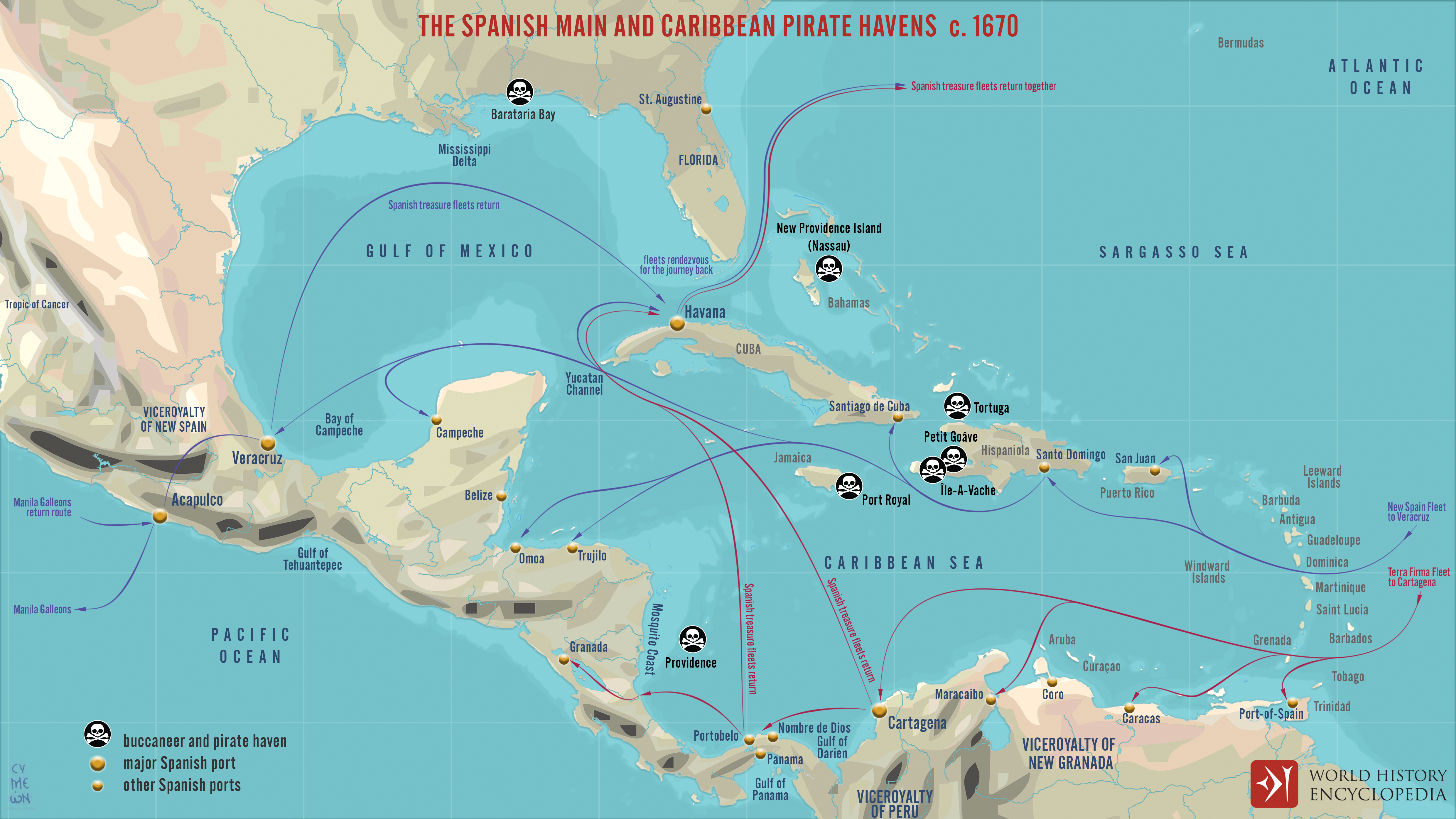
This map illustrates the maritime routes of Spain’s Treasure Fleets and the network of Caribbean ports and pirate havens around 1670. It captures the tension between imperial commerce and maritime raiding, showing both the logistical arteries of the Spanish Empire and the hotspots of buccaneer activity that flourished in its shadow.
The map traces the paths of the New Spain and Terra Firma Fleets, which transported gold, silver, and goods from the Americas to Europe. These convoys followed carefully guarded routes connecting the Spanish Main—the mainland colonies along the Caribbean coast—and the islands of the Spanish West Indies. Alongside these official trade lines, the map marks key pirate and buccaneer strongholds such as Tortuga, Port Royal, and Providence Island, where privateers and freebooters preyed on treasure ships. By the late 17th century, this region had become a volatile maritime frontier, where imperial ambition met seaborne rebellion, and wealth flowed in both sanctioned and stolen forms.