
Server Costs Fundraiser 2026

Map of Spanish Main & West Indies c.1720

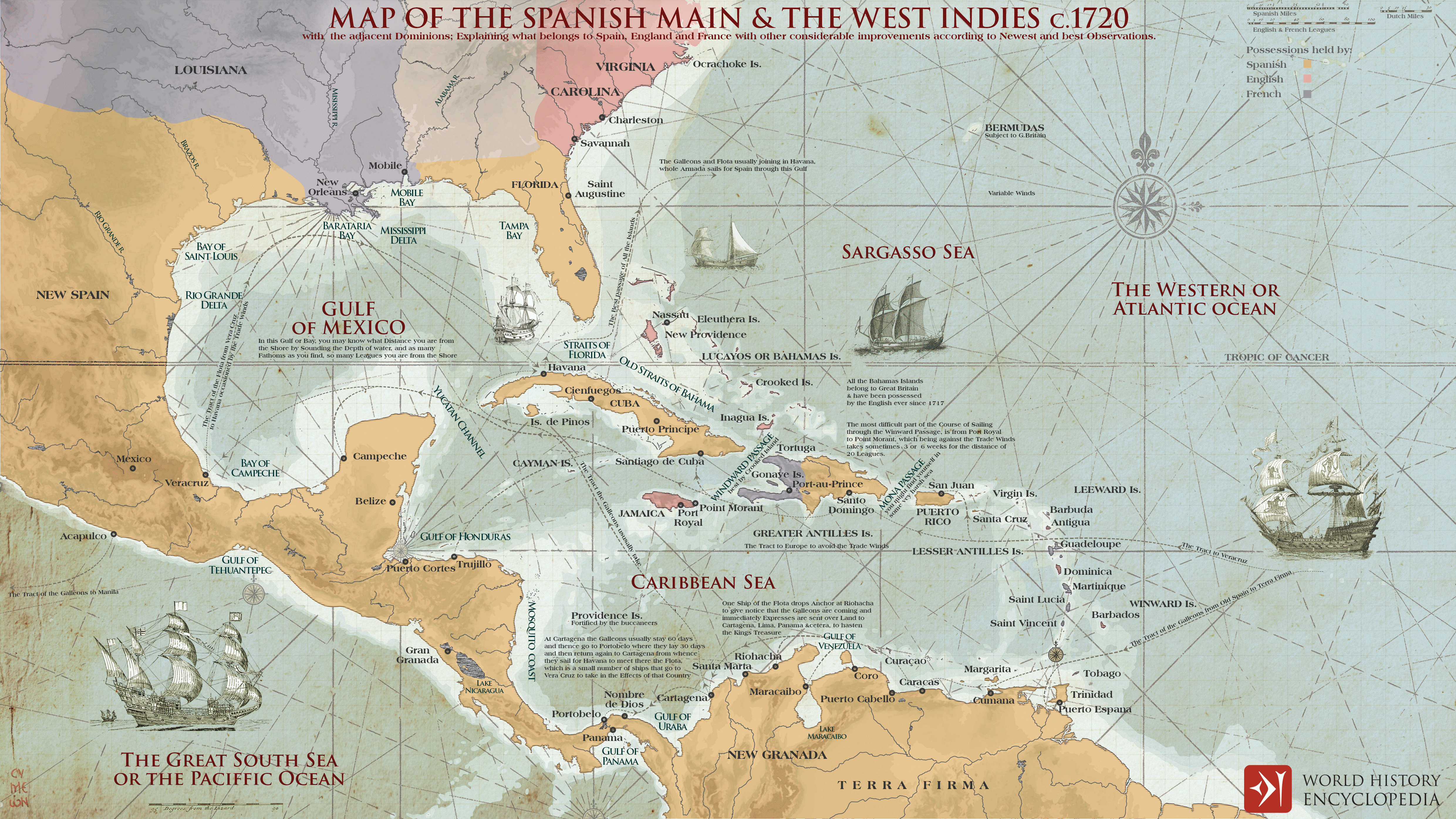
During the 18th century, the Caribbean Sea and the Gulf of Mexico formed one of the most strategically contested regions of the Atlantic world. Initially dominated by the Spanish Empire, this maritime zone, often referred to as the Spanish Main and the West Indies, became a focal point of imperial rivalry involving Spain, Britain, and France. The weakening of Spanish exclusivity, particularly after the late 17th century, opened space for competing colonial powers to establish footholds across key islands and coastal enclaves. These struggles unfolded through warfare, privateering, and commercial competition, as control over ports, sea lanes, and plantation economies became central to imperial strategy. By the mid-18th century, conflicts such as the War of the Austrian Succession and the Seven Years’ War further intensified these contests, reshaping the balance of power across the Caribbean basin.
At the center of this system were the Spanish treasure fleets, which linked American colonies to Europe through regulated and heavily defended maritime routes. These convoys transported silver from mining centers such as New Spain and Peru, alongside gold, dyes, and other valuable goods, forming the backbone of transatlantic commerce. Their predictable routes made them prime targets for privateers and rival naval forces, reinforcing the militarization of Caribbean waters. The fleet system not only sustained Spain’s global empire but also stimulated the expansion of rival maritime powers, whose efforts to disrupt or penetrate this network contributed to the emergence of a more competitive and interconnected Atlantic economy.