
Search Images
Browse Content (p. 1675)
Image
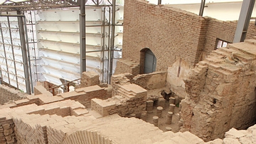
Ephesus Terrace Houses: Archway
The terrace homes in Ephesus give a glimpse of how the wealthy lived during the Roman period The oldest building dates back into the 1C BCE and continued in use as a residence until the 7C CE.
Image
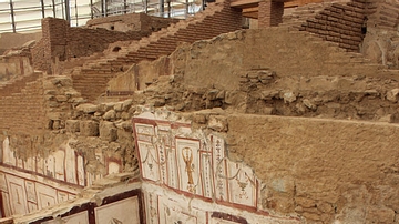
Ephesus Terrace Houses: Dinning Hall
The terrace homes in Ephesus give a glimpse of how the wealthy lived during the Roman period The oldest building dates back into the 1C BCE and continued in use as a residence until the 7C CE.

Image
Fresco Showing the Riot of 59 CE in the Amphitheatre of Pompeii
Fourth Style fresco depicting a riot that broke out in Pompeii in 59 CE during games held in the arena involving Pompeians and inhabitants of Nuceria. On the orders of Nero, this event led to the closure of the amphitheatre for ten years...

Image
"Sappho" fresco, Pompeii
Fresco showing a woman holding writing implements, a wax tablet and stylus. Commonly called Sappho, the fresco actually portrays a high-society Pompeian woman, richly dressed with gold-threaded hair and large gold earrings. From Pompeii...
Image
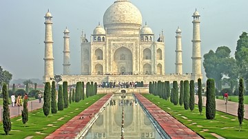
Taj Mahal
The Taj Mahal, Agra. Built in 1634 CE by Shah Jahan as a mausoleum for his favourite wife Mumtaz Mahall.
Image
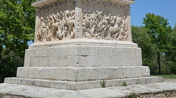
Mausoleum of the Julii
The Mausoleum of the Julii at Glanum, southern France, is one of the best preserved mausoleums of the Roman era. Based on its artistic style, the Mausoleum was probably built between 40 and 20 BCE. An inscription mentions that three Julius...
Image
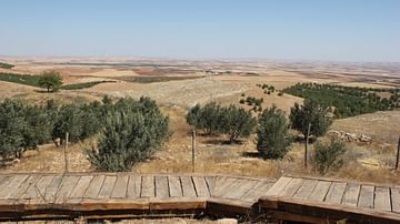
The plains of Göbekli Tepe
The view from Göbekli Tepe (10,000 BCE) to the north of the site.
Image
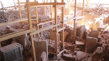
Göbekli Tepe: Site
One of the temples found at Göbekli Tepe underneath the newly constructed covering. (approx. 10,000 BCE)
Image
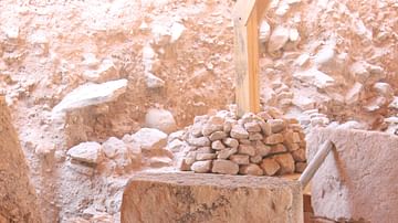
Göbekli Tepe: Pillar
T-shaped monolithic limestone pillar which contains carvings of animals as well as abstract characters and icons. (approx. 10,000 BCE)

Image
Roman Theatre of Hierapolis
The Roman theatre of Hierapolis in Phrygia (Turkey) was built in the 2nd century CE under Emperor Hadrian on the ruins of an earlier theatre following a devastating earthquake in 60 CE. It was later renovated under Septimius Severus (193-211...