


Rhine frontier of the Roman empire, 70AD, showing the location of the Batavi in the Rhine delta region. Roman territory shaded darker.
Related Images

Rhine Frontier of the Roman Empire, 4th century CE.
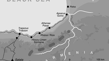
The Caucasian Frontier of the Roman Empire

Map of the Provinces of the Roman Empire under Augustus

Map of the Roman Empire under Theodosius the Great, c.395 - The Last Unified Roman Empire

Map of the Diocletian's First Tetrarchy and the Roman Empire - Stability Through Division, Succession by Design

Map of the Roman Empire under the Flavians (69–96 CE) - Stability after Civil War
Cite This Work
APA Style
Erren, H. (2012, April 26). Map of the Rhine frontier of the Roman empire, 70AD. World History Encyclopedia. https://www.worldhistory.org/image/549/map-of-the-rhine-frontier-of-the-roman-empire-70ad/
Chicago Style
Erren, Hans. "Map of the Rhine frontier of the Roman empire, 70AD." World History Encyclopedia, April 26, 2012. https://www.worldhistory.org/image/549/map-of-the-rhine-frontier-of-the-roman-empire-70ad/.
MLA Style
Erren, Hans. "Map of the Rhine frontier of the Roman empire, 70AD." World History Encyclopedia, 26 Apr 2012, https://www.worldhistory.org/image/549/map-of-the-rhine-frontier-of-the-roman-empire-70ad/.