

 2
2
This text is available in other languages:

A map of the Magellan–Elcano expedition (1519–1522), a Spanish-sponsored maritime voyage authorized under Charles I of Spain (reign 1516–1556; later Holy Roman Emperor Charles V, reign 1519–1556) to find a westward route to the Spice Islands/Moluccas. Commanded first by Ferdinand Magellan (c. 1480–1521), the fleet departed Spain with five ships, crossed the Atlantic, explored the coast of South America, passed through the Strait of Magellan, and entered the Pacific Ocean. The voyage reached Guam and the Philippines, where Magellan was killed at Mactan in 1521.
After further losses, Juan Sebastián Elcano (c. 1476–1526) commanded the Victoria westward from the Moluccas across the Indian Ocean, around the Cape of Good Hope, and back to Spain in September 1522. Although only one ship and 18 survivors returned, the expedition completed the first recorded circumnavigation of the world. Its outcome transformed European geographic knowledge, confirmed the vast scale of the Pacific, intensified Iberian rivalry over global trade routes, and connected Atlantic, Pacific, and Indian Ocean worlds within a single navigable framework.
About the Author
Related Images

The Twelve Longest Discovery Expeditions in the Age of Sail - Exploration, Science, and the Expansion of Global Knowledge

5 Famous Ships of the Age of Exploration - From Dias to Magellan, 1487–1522

Map of Spanish Conquest & Exploration in North America

Map of Arctic Discovery and Exploration
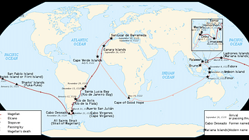
Map of Ferdinand Magellan's Circumnavigation
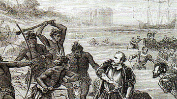
Death of Ferdinand Magellan
Cite This Work
APA Style
Netchev, S. (2026, July 24). Map of the Magellan–Elcano Voyage, 1519–1522: The First Recorded Circumnavigation of the World. World History Encyclopedia. https://www.worldhistory.org/image/21955/map-of-the-magellan-elcano-voyage-1519-1522/
Chicago Style
Netchev, Simeon. "Map of the Magellan–Elcano Voyage, 1519–1522: The First Recorded Circumnavigation of the World." World History Encyclopedia, July 24, 2026. https://www.worldhistory.org/image/21955/map-of-the-magellan-elcano-voyage-1519-1522/.
MLA Style
Netchev, Simeon. "Map of the Magellan–Elcano Voyage, 1519–1522: The First Recorded Circumnavigation of the World." World History Encyclopedia, 24 Jul 2026, https://www.worldhistory.org/image/21955/map-of-the-magellan-elcano-voyage-1519-1522/.
