

This text is available in other languages:

The opening of the Suez Canal on 17 November 1869 marked a major transformation in global maritime commerce, linking the Mediterranean and Red Seas through a direct sea-level canal across the Isthmus of Suez. Constructed between 1859 and 1869 under the leadership of Ferdinand de Lesseps, the project dramatically shortened sea routes between Europe and Asia by eliminating the need to navigate around the Cape of Good Hope. Built during the reign of Isma'il Pasha (reign 1863–1879), the canal reflected both the technological ambitions of the industrial age and Egypt’s growing integration into global commercial and imperial systems. Its route also revived a much older strategic concept, echoing earlier canals that had linked the Nile and Red Sea in pharaonic, Persian, and early Islamic periods.
The canal rapidly became one of the most important arteries of international trade and imperial communication, particularly for European powers seeking faster access to the Indian Ocean and East Asia. Although initially developed through a Franco-Egyptian partnership, its strategic significance increasingly drew British involvement, especially after Britain purchased Egypt’s canal shares in 1875 under under Prime Minister Benjamin Disraeli (in office 1868, 1874–1880) and later occupied Egypt in 1882.
About the Author

Related Images

Map of the Hanseatic League Trade Network, c. 1400

Map of the East India Company Trade, c.1800

Phoenician Trade Network

Map of the Akkadian Empire at Its Height - Ruling the Four Quarters of the World

Map of the Trade Networks of the Roman Empire - Commerce & the Connectivity in the Mediterranean 1-3 c. CE
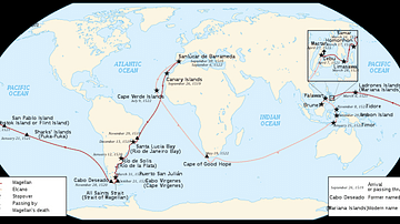
Map of Ferdinand Magellan's Circumnavigation
Cite This Work
APA Style
Netchev, S. (2026, May 18). Map of the Suez Canal at its Opening, c. 1869: Engineering, Empire, and the Remaking of Global Trade. World History Encyclopedia. https://www.worldhistory.org/image/21808/map-of-the-suez-canal-at-its-opening-c-1869/
Chicago Style
Netchev, Simeon. "Map of the Suez Canal at its Opening, c. 1869: Engineering, Empire, and the Remaking of Global Trade." World History Encyclopedia, May 18, 2026. https://www.worldhistory.org/image/21808/map-of-the-suez-canal-at-its-opening-c-1869/.
MLA Style
Netchev, Simeon. "Map of the Suez Canal at its Opening, c. 1869: Engineering, Empire, and the Remaking of Global Trade." World History Encyclopedia, 18 May 2026, https://www.worldhistory.org/image/21808/map-of-the-suez-canal-at-its-opening-c-1869/.