


These maps illustrate the trajectory of the early Crusades (1096–1192), a series of military campaigns launched by the medieval Latin Church with the declared goal of reclaiming the Holy Land—centered between the Mediterranean Sea and the eastern bank of the Jordan River—from Muslim control. Spurred by religious zeal, political ambition, and the promise of salvation, these expeditions drew tens of thousands of knights, nobles, and commoners from across Europe.
The First Crusade (1096–1099) culminated in the conquest of Jerusalem and the founding of Latin Christian states in the Levant. These included the County of Edessa, the Principality of Antioch, the County of Tripoli, and the Kingdom of Jerusalem—collectively referred to as Outremer (Old French for "overseas"). Subsequent campaigns, including the Second Crusade (1147–1148) and Third Crusade (1187–1192), attempted to defend or recover these territories, which remained under constant threat from surrounding Muslim powers.
About the Author

Related Images

Map of the Crusader States (Outremer), 1096-1291

Map of the First Crusade, 1096 - 1099
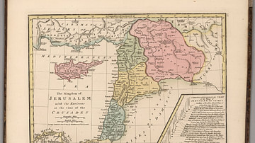
Kingdom of Jerusalem at the Time of the Crusades

Map of the Crusader States, 1229-1240 CE

Map of the Trade Networks in the Middle Ages, c. 1200

Crusader States 1200 CE
Cite This Work
APA Style
Netchev, S. (2022, March 14). Map of the First Three Crusades & the 12th-Century Outremer. World History Encyclopedia. https://www.worldhistory.org/image/15382/map-of-the-first-three-crusades--the-12th-century/
Chicago Style
Netchev, Simeon. "Map of the First Three Crusades & the 12th-Century Outremer." World History Encyclopedia, March 14, 2022. https://www.worldhistory.org/image/15382/map-of-the-first-three-crusades--the-12th-century/.
MLA Style
Netchev, Simeon. "Map of the First Three Crusades & the 12th-Century Outremer." World History Encyclopedia, 14 Mar 2022, https://www.worldhistory.org/image/15382/map-of-the-first-three-crusades--the-12th-century/.