
Search
Remove Ads
Advertisement
Search Results

Image
Map of Europe after the Congress of Vienna, 1815
The Congress of Vienna (September 1814–June 1815) marked a decisive attempt by Europe’s great powers to reconstruct political order after more than two decades of revolutionary and Napoleonic warfare (1792–1815). Led principally by Austria...

Image
Map of the Migration Period in Europe in the 4th-5th Century
The Migration Period in Europe (c. 4th–6th centuries CE) marks a prolonged era of movement, conflict, and political transformation rather than a single moment of collapse. Following the death of Emperor Theodosius I (reign 379–395 CE) and...

Image
Europe after The Treaty of Versailles
This map illustrates the situation in Europe in November 1920 in the aftermath of First World War (1914-18), as the continent was reshaped by the Treaty of Versailles (1919) and the Treaty of Sèvres (1920). The German Empire had collapsed...

Image
Map of Europe Before the Fall of Constantinople, c. 1450
Around 1450 CE, Europe and the Middle East were defined by fragmentation, declining medieval powers, and the rise of new regional states. The Byzantine Empire had contracted to Constantinople and a few outposts, while the Ottoman Empire under...

Image
Map of Europe after the Congress of Berlin, 1878 - From Italian and German Unification to Balkan Crisis
The mid-19th century transformation of Europe was driven above all by the unification of Italy and Germany, which reduced long-standing political fragmentation and introduced powerful new nation-states into an already competitive continental...

Image
Map of Elizabethan Trade with Europe, c. 1600 - Trade and Diplomacy in the Tudor World
During the reign of Queen Elizabeth I (reign 1558–1603), England underwent a decisive commercial transformation, expanding its trade networks across northern and southern Europe at a moment of shifting geopolitical and economic balance. The...

Image
Prominent Cities of Europe from Antiquity to the Present
A map of Europe displaying important cities that shaped its history, from antiquity to the present. Cities on the map represent key centers throughout history. Each city represents a distinct period from Athens, Rome, and Constantinople (now...

Image
Map of the Holocaust in Europe during World War II
During World War II (1939-1945), Nazi Germany under Adolf Hitler (rule 1933-1945) carried out the Holocaust, a systematic, state-directed genocide that resulted in the murder of approximately six million Jews, alongside millions of other...
Image
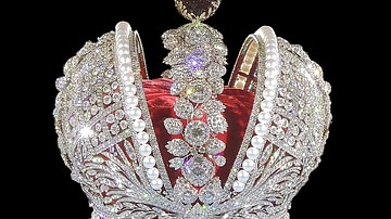
Modern Replica of the Imperial Russian Crown
Modern replica of the Russian imperial crown, made as part of the Jewellery project "Creation of Imperial Crown of Russia in modern interpretation" to celebrate the 50th anniversary of the diamond industry in Russia, using white gold (the...

Image
The Feudal Society in Medieval Europe - Power in Medieval Europe: Lords, Land & the Church
The social structure of medieval Western Europe (c. 10th–13th centuries) is often described through the framework of feudal relationships and landholding systems that linked rulers, nobles, and rural communities. In this model, political...