
Search
Remove Ads
Advertisement
Search Results

Image
Map of Tartessos with Phoenician and Greek colonies
A map of Tartessos, showing its sphere of influence, as well as Greek and Phoenician colonies in southern Spain.

Image
Phoenician Ship in a Storm
Artist's rendition of a Phoenician ship at sea during a storm. The Phoenicians were a great maritime people and often adorned their ships with horses' heads to honour Yamm, their god of the sea. Although Yamm could raise the seas to sink...

Video
History of the Phoenicians: The Maritime Superpowers of the Mediterranean
The Phoenicians were the maritime superpowers of the Mediterranean. Their culture flourished and was at its most powerful between 1500 and 332 BCE when Alexander the Great entered the region and decimated the cities and their populations...
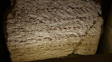
Image
Phoenician Foundation Inscription from Sidon
The inscription reads (in Phoenician) "Bodastarte, the son of Eshmunazar, the king of Sidon, has ordered this temple to be built for the god Eshmun". Second half of the sixth century BCE. From the foundation wall of the Eshmun Temple at Sidon...

Image
Fleeing Phoenician Queen
This gypsum fragment shows a Phoenician queen holding a baby, fleeing in a boat from the invading Assyrian army. It was once part of limestone relief at the Throne room I of Sennacherib's palace at Nineveh. From the South-West Palace, Nineveh...

Definition
Portuguese Malacca
The Portuguese colonised Malacca (modern Melaka) on the southwest coast of the Malay peninsula from 1511 and kept it until 1641 when the Dutch took over. The port controlled the Malay Straits which lead from the Indian Ocean (the Andaman...

Image
Map of the Trade Networks of the Roman Empire - Commerce & the Connectivity in the Mediterranean 1-3 c. CE
The prosperity of the Roman Empire (27 BCE-476 CE in the West) rested not only on military power and administration but also on an extensive network of maritime and overland trade routes that connected communities across Europe, North Africa...

Image
Phoenician-Assyrian Warship
This gypsum wall relief depicts a warship. This ship was built and manned by Phoenicians employed by Sennacherib. It is a bireme, with two rows of oars. Shields are fastened around the superstructure, as on the fortifications of some city...

Definition
John Hawkins
Sir John Hawkins (1532-1595 CE) was an Elizabethan mariner, merchant and naval administrator who has the inglorious (if not wholly accurate) record of being England's first slave trader. In the 1560s CE Hawkins trafficked slaves from West...

Image
Map of the Trade in the Indian Ocean 15th-16th century - From Afro-Asian Exchange to European Intervention
The Indian Ocean trade network of the 15th and 16th centuries formed one of the most extensive and dynamic systems of exchange in the premodern world, linking East Africa, the Middle East, South Asia, and Southeast Asia. This maritime system...