
Search
Search Results
Image
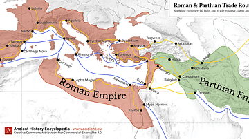
Map of Roman & Parthian Trade Routes
This map shows the Roman-Parthian trade route system, circa between the 1st and the 3rd centuries CE. During this period, the Roman Empire and the Parthian Empire were the two superpowers of the region and the Roman-Parthian trade system...
Image
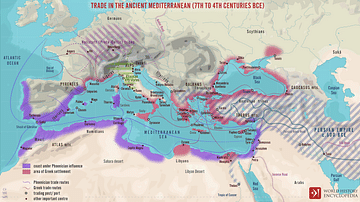
Trade Routes in the Ancient Mediterranean
A map illustrating the boundaries, spheres of influence, and the flow of trade around the Mediterranean Sea between the 7th and 4th centuries BCE.
Image
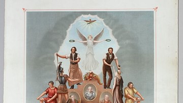
Trade Union Scroll for the Amalgamated Society of Engineers
A trade union scroll for the Amalgamated Society of Engineers, created in January 1851. The scroll shows illustrations of important engineers and inventions during the Industrial Revolution. (Science Museum, London)
Collection
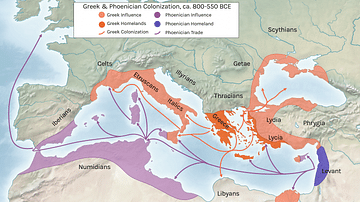
Colonization in the Ancient Mediterranean
Colonization of the ancient Mediterranean had been taking place since the Bronze Age, especially with Minoan and Mycenaean expansion, but it was the Phoenicians from the 10th century CE that really took the whole idea to a new level. The...
Collection
Precious Materials in Antiquity
Certain materials have always been precious such as gold for its lustre, incorruptibility, and ease to work but some ancient cultures often gave a very high value to more unusual materials. The Romans loved Tyrian purple dye, the Incas prized...
Image
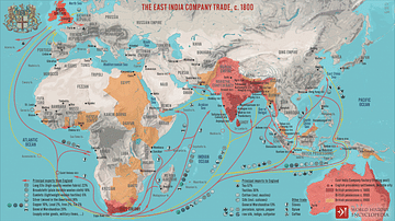
The East India Company Trade, c. 1800
A map illustrating the markets and goods traded by the East India Company (EIC) with East and Southeast Asia and India around 1800. Incorporated on December 31, 1600, by Queen Elizabeth I's Royal Charter, it was given an initial 15-year monopoly...
Image
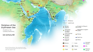
Ancient Indian Maritime Trade Routes
This map is derived from the book Periplus of the Erythraean Sea. It depicts trade routes in the ancient world, ports in the Chera territory and other parts of India and the trade routes connecting them to other parts of the world along with...
Image
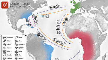
Transatlantic Triangular Trade Map
Map showing the flow of goods and enslaved people across the Atlantic between Europe, Africa and America in the transatlantic triangular trade which the European colonial powers operated from the 16th to the 19th centuries CE. This triangular...
Image
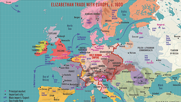
Elizabethan Trade with Europe, c. 1600
A map illustrating the flourishing English trade with Europe during the reign of Queen Elizabeth I of England (r. 1558-1603). Following the abolishment of the Hanseatic merchants' Baltic monopoly, access to a new commodities market in Amsterdam...
Image
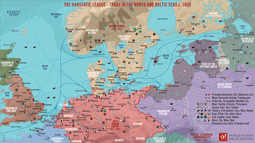
The Hanseatic League - Trade in the North and Baltic Seas c. 1400
A map illustrating the expanse and complexity of the northern Europen trade network of commerce and the powerful association of cities and merchant guilds known as the Hanseatic League (from Old High German - Hanse for “guild,” or “association,”...