
Search
Remove Ads
Advertisement
Search Results

Image
Map of Eastern Mediterranean in 1450 CE
Geopolitical climate in the Eastern Mediterranean before the conquest of Constantinople in 1453 CE.

Image
476: The New Political Face of the Western Mediterranean
The map show the political situation within the western regions of the Mediterranean after the deposition of the last Western emperor, Romolus Augustulus, by Odoacer, the commander of the Italian imperial army. In reality, the Western Roman...
Image
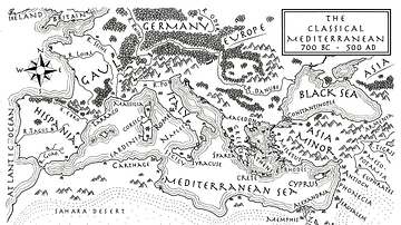
Mediterranean Map
Mediterranean Map from the novel The Jericho River.

Image
Empires of the Mediterranean, 218 BCE.
A map showing the various empires throughout the Mediterranean in 218 BCE.
Image
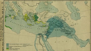
The Assyrian Empire and the Region about the Eastern Mediterranean, 750-625 BC
The Assyrian Empire and the Region about the Eastern Mediterranean, 750-625 BC.
Image
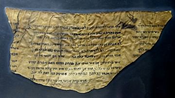
Dead Sea Scroll of Pesher Isaiah
This is part of Pesher Isaiah, scroll number 4Q162, which was found in Cave 4 at Qumran (Khirbet Qumran or Wadi Qumran). A pesher is a type of commentary. The Dead Sea Scrolls are ancient Jewish religious manuscripts. The majority were written...
Image
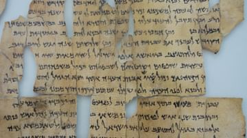
Dead Sea Scrolls
The Dead Sea Scrolls (DSS) are a collection of scrolls found in the desert east of Jerusalem on the shore of the Dead Sea. They represent the largest manuscript collections of texts from the Second Temple Period found in the area of Judah...

Image
Ariake Sea and Yushima at Hara Castle
The Ariake Sea and Yushima at Hara Castle, photograph by Matthew Allison, 4 October 2025. Hara Castle, Minamishimabara, sits on the coastline of the Ariake Sea, as photographed above. It was along this shoreline that the rebels of the Shimabara...

Image
Periplus of the Erythreaen Sea
Trade routes of the ancient Romans to Africa and India as described in the 1st-century CE Periplus of the Erythreaen Sea.

Image
Some Active Trade Routes in the Bronze Age Mediterranean
A map detailing some of the active maritime trade routes in the Aegean during the Middle and Late Bronze Age.