
Search
Remove Ads
Advertisement
Search Results

Video
Looking East, Looking West: Mughal Painting between Persia and Europe
Looking East, Looking West: Mughal Painting between Persia and Europe November 19, 2015 Getty Center Lecture by Kavita Singh Introductory remarks by Thomas W. Gaehtgens and Brian...

Image
Emperor Charles the Fat & King Louis III the Younger of East Francia
Engraved portrait of Kings of East Francia Charles the Fat (r. 876-887 CE), Holy Roman Emperor (r. 881-887 CE), and Louis III the Younger (r. 876-882 CE), by unknown creator, c. 1634-1643...

Image
Map of East Frisia
Map of East Frisia by the Dutch Johannes Florianus (1522-1585) for the Theatrum Orbis Terrarum, one of the first accurate modern atlas, 1595.
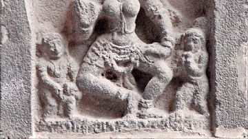
Image
Dancer, East Gopura, Chidambaram
A dancer, one of hundreds, from the facade of the east gopura (gateway) of the Nataraja temple, Chidambaram, Tamil Nadu, India. c.1200 CE.
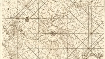
Image
Map of the East Coast from the River Thames to Edinburgh
Map of the East Coast from the River Thames to Edinburgh, from Great Britain's Coasting Pilot,ink on paper by Greenville Collins, c. 1682-1694. Probably drafted in 1682 but not published until 1693...

Image
The Near East in 1135 CE
This map of the Near East in 1135 CE shows four Crusader States (marked with red crosses) in relation to other powerful kingdoms in the period between the first and second crusades.

Image
East Pediment of the Parthenon
The left section of the east pediment of the Parthenon. On the far left Helios and his chariot rise from the base of the pediment, next is Dionysos reclining, then the figures are female deities, possibly Demeter...

Article
Caesarea Maritima's Role in the Mediterranean Trade
Caesarea Maritima was located on the eastern coast of the Mediterranean Sea. Built from the ground up in 22-10 BCE by Rome's client king, Herod the Great (r. 37-4 BCE), its location in relation to ship...

Article
Battle of Ferozeshah
The Battle of Ferozeshah (aka Forezeshur) on 21-22 December 1845 was one of four major battles during the First Anglo-Sikh War (1845-6) between the Sikh Empire and the British East India Company (EIC). The British relentlessly...

Image
Map of the Middle East during the Second Fitna (c. 686 CE)
A map depicting the divisions of the Islamic Empire during the second Islamic civil war - the Second Fitna. The dominions of the Umayyads, Zubayrids, Kharjites, Al Mukhtar and those regained by...
