
Search
Remove Ads
Advertisement
Search Results

Image
Rank Badge with Qilin (Late 17th Century)
Rank badge with qilin, silk and metallic thread embroidery on plain-weave silk patterned in gauze, by an unknown artist, China, late 17th century China. This embroidered rank badge is from the Qing Dynasty...
Image
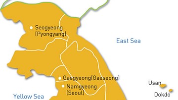
Map of the Goryeo Empire (11th century CE)
A map of the territory controlled by the Goryeo Dynasty of Korea in the 11th century CE. The Goryeo reigned from 918 to 1392 CE.
Image
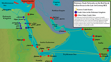
Ptolemaic Trade Networks in the Late 1st Century BCE
This map illustrates the trading networks which connected the Ptolemaic Kingdom to South Asia and East Africa by the second half of the 1st century BCE. During this time period, Ptolemaic Egypt was...

Image
The South China Sea in the 18th Century
A late-18th century map of the South China Sea. Drawn by Rigobert Bonne and G. Raynal

Image
Map of France, 10th Century CE
A map of France in the 10th century CE.

Image
Roman Forum in the 5th Century BCE
A painting of the Roman Forum as it probably would have appeared in the 5th Century BCE. By Vilius Petrauskas.
Courtesy of Ancient History Magazine / Karwansaray Publishers.

Image
Rhine Frontier of the Roman Empire, 4th century CE.
A map showing the Rhine frontier of the Roman Empire in the 4th century CE.
Image
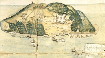
17th Century Tortuga
A 17th-century illustration of the buccaneer and pirate base of Tortuga, located on the northwest coast of Hispaniola (modern Haiti and the Dominican Republic).

Image
17th-Century Siege Artillery Tactics
An early 17th-century illustration by Johann Jacob von Wallhausen showing the tactics of batteries of siege artillery to fire upon a specific point in the defensive fortifications.

Image
China Warlords, 2nd-3rd century CE.
A map showing the territories of the main Chinese warlords at the fall of the Han dynasty in the early 3rd century CE.
