
Search
Remove Ads
Advertisement
Search Results
Image
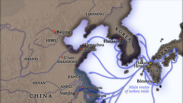
Wako Raids During the 16th century CE
A map showing the raids made by wako pirates during the 16th century CE.
Image
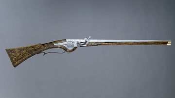
17th-Century Wheellock Carbine
A French 17th-century wheellock carbine. This type of weapon was typically used by cavalrymen, for example, during the English Civil Wars. (1642-51). This example is particularly ornate since it was possibly made for Louis XIII of France...
Image
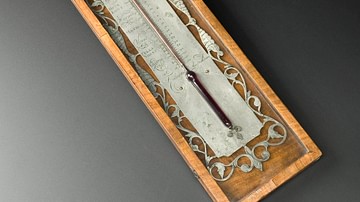
18th-Century Alcohol Thermometer
An 18th-century alcohol thermometer. Made in the Netherlands between 1720 and 1750. (Science Museum, London)
Image
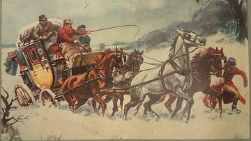
19th-Century Coach Caught in Snow
A picture of a 19th-century coach caught in the snow. From a tin produced by Excelvit. (Private Collection)
Image
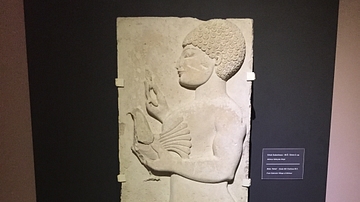
Lydian Relief: 5th Century BCE
This relief of a male holding a bird is from the 5th century BCE, found in modern day western Turkey near the ancient city of Thyatira. Thyatira was named such by Seleucos I Nicator around 290 BCE but prior to that it was an important city...

Image
Hydria (4th century BCE)
The hydria, as its name indicates, was used almost exclusively for carrying water (Greek hydor), essential for everyday cleansing, ritual purifications and libations. 4th-century BCE. Made from bronze. (Hellenic Museum, Melbourne, Victoria)

Image
19th-Century Christmas Card
A late-19th century Christmas card showing a robin and snow scene. The border is perforated to resemble lace. (Victoria and Albert Museum, London) Orignal source note on usage: 'V&A Owned Content' in which the V&A owns copyright (or related...

Image
Map of Viking Exploration, 8th-11th Century
This map illustrates the sweep of Viking exploration between the late 8th and early 11th centuries, charting longship routes from Scandinavia to the British Isles, Normandy, Iberia, Russia, the Mediterranean, and across the North Atlantic...

Image
Map of Japan in the 16th Century CE
A map of Japan during the Azuchi-Momoyama period (1568-1600 CE).

Image
11th century CE Kievan Rus Territories
Map of Kievan Rus territories during the feudal split, after the death of Prince Yaroslav the Wise in 1054 CE.