
Search
Remove Ads
Advertisement
Search Results
Image
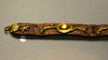
16th-Century Dog Collar
Dog collar found in Amsterdam, dated to 1575-1600.
Rijksmuseum van Oudheden, Leiden.
Image
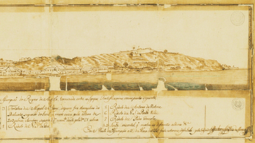
Luanda in the 18th Century
A 1755 illustration of the port of Luanda, capital of the colony of Portuguese Angola and capital of today's Angola. Luanda was one of the major points of assembly for African slaves destined for the Americas.

Image
10th-century Equatorium
Equatorium of Jafar al-Khazin (900-971 CE).
Istanbul Museum of the History of Science and Technology in Islam.
Image
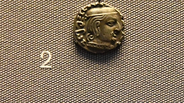
3rd Century CE Indian Coin with Date
In the ancient world, some coins had dates on them. giving us precise information as to when people ruled. These coins are inscribed with dates, so they give fixed points in the chronology of ancient states, to which other evidence can be...
Image
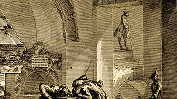
Columbarium Being Stripped Bare by 18th-Century Treasure Hunters
From the 15th-18th centuries CE, the many columbaria that lined the consular highways leading out of Rome were plundered and destroyed. Consequently, one sees bits and pieces of them cemented into the walls of villas and palazzos all over...

Image
19th-century Drawing of Weetamoo
Drawing of Weetamoo (l. c. 1635-1676) from page 48 of Frost's Pictorial History of Indian Wars and Captivities by John Frost, 1873.

Video
The Crisis of the Third Century Explained
The Crisis of the Third Century (also known as the Imperial Crisis, 235-284 CE) was the period in the history of the Roman Empire during which it splintered into three separate political entities: the Gallic Empire, the Roman Empire, and...

Video
Sultan Suleiman Marries Hurrem | Magnificent Century
Sultan Suleiman Marries Hurrem | Magnificent Century Click to watch full episode: https://www.youtube.com/watch?v=cooAiT3JY8k The golden years of the Ottoman Empire come to life in a television series. The life of Suleiman the Magnificent...

Video
The Roman Empire: Crisis of the 3rd Century - Full Documentary
The Crisis of the Third Century, also known as Military Anarchy or the Imperial Crisis (AD 235–284), was a period in which the Roman Empire nearly collapsed under the combined pressures of invasion, civil war, plague, and economic depression...

Video
18th Century CE Warfare: Crash Course
European powers had a lot of wars in the 18th Century CE, and they weren't confined to Europe. Conflict raged across the globe, in what might be called a World War...but we don't call it that, because we already have a couple of those coming...