

Map of the Fall of the Western Roman Empire, c. 480 CE

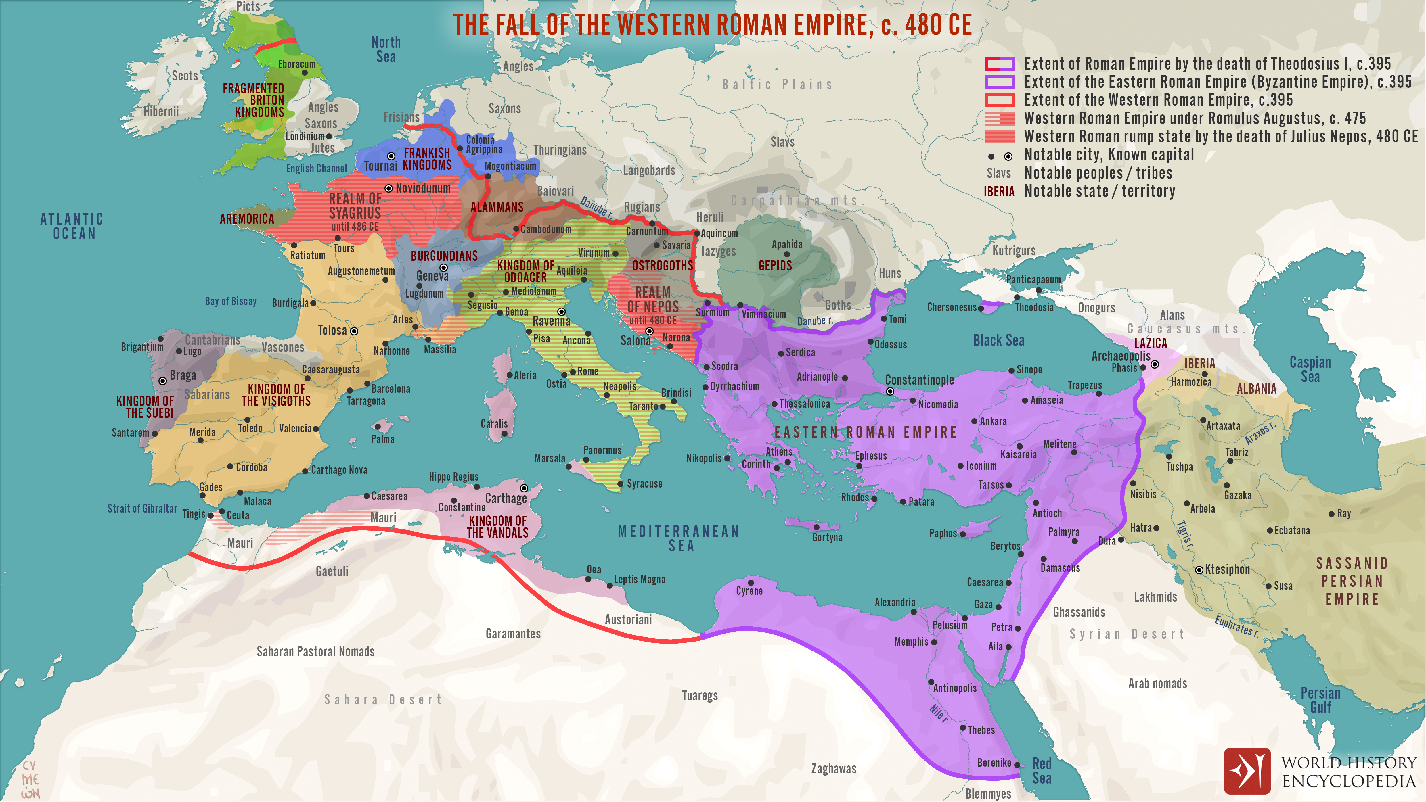
The disintegration of the Western Roman Empire unfolded gradually during the Migration Period (c. 400–800 CE), as waves of migrating and invading peoples reshaped Europe. After the death of Theodosius I (reign 379–395 CE), the last emperor to govern both East and West, the empire was formally divided, leaving the weaker Western half vulnerable. Over the following decades, military defeats, economic strain, and internal instability combined with external pressures from Visigoths, Vandals, Huns, and other groups, eroding imperial authority. The conventional “fall” is often dated to 476 CE, when Romulus Augustulus (reign 475–476) was deposed, or to 480 CE, with the assassination of Julius Nepos (reign 474–480), the last legitimate Western emperor.
Yet Roman power and traditions did not vanish overnight. Latin remained the language of administration, Roman law and coinage persisted, and successor kingdoms drew heavily on Roman models of governance and military organization. Italy, Gaul, Hispania, and North Africa came under the control of groups such as the Ostrogoths, Visigoths, Vandals, and later the Franks, who both disrupted and assimilated Roman traditions. Rather than a sudden collapse, the Migration Period marked a protracted transformation, blending imperial legacies with emerging medieval political and cultural structures that would define Europe’s future.