

Map of the Roman Trade Network (1st - 3rd centuries CE)

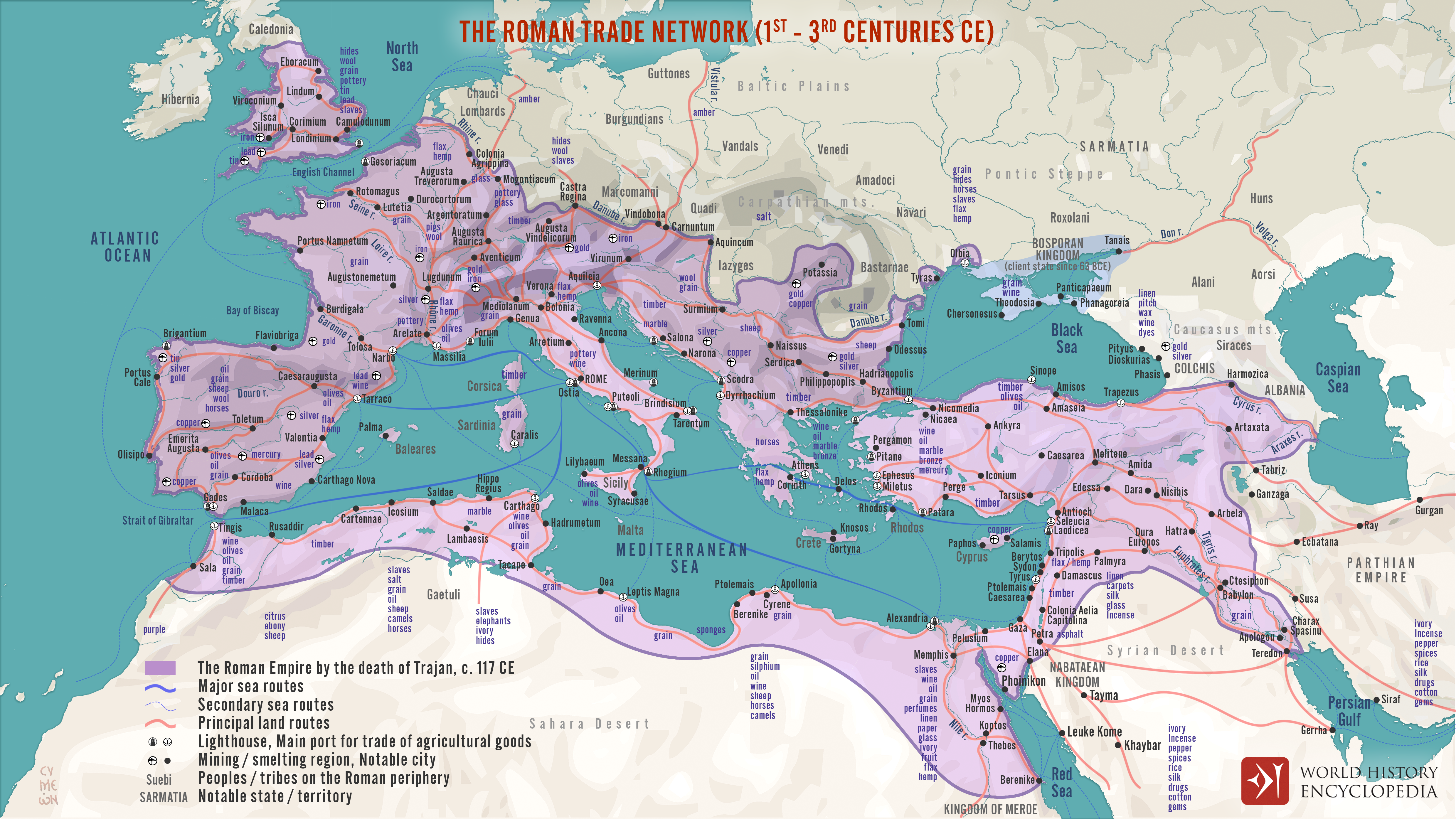
This map illustrates the main maritime and overland trade arteries that bound the Roman Empire together between the first and third centuries CE. From grain fleets in the Mediterranean to camel caravans across the desert and river barges on the Rhine and Nile, commerce moved people, ideas, and luxury goods.
The routes are schematic: ancient pilots adjusted courses to shifting Mediterranean winds, so outbound and return tracks often differed, and exact sea lanes remain only partly known. Overland, merchants stitched provinces together via a web of paved roads, rivers, and canals whose complexity varied from Gaul to Syria. By visualizing these flexible corridors—rather than fixed “highways”—the map captures how Roman connectivity relied on season, terrain, and local infrastructure as much as imperial reach.