

Map of the Provinces of the Roman Empire under Augustus

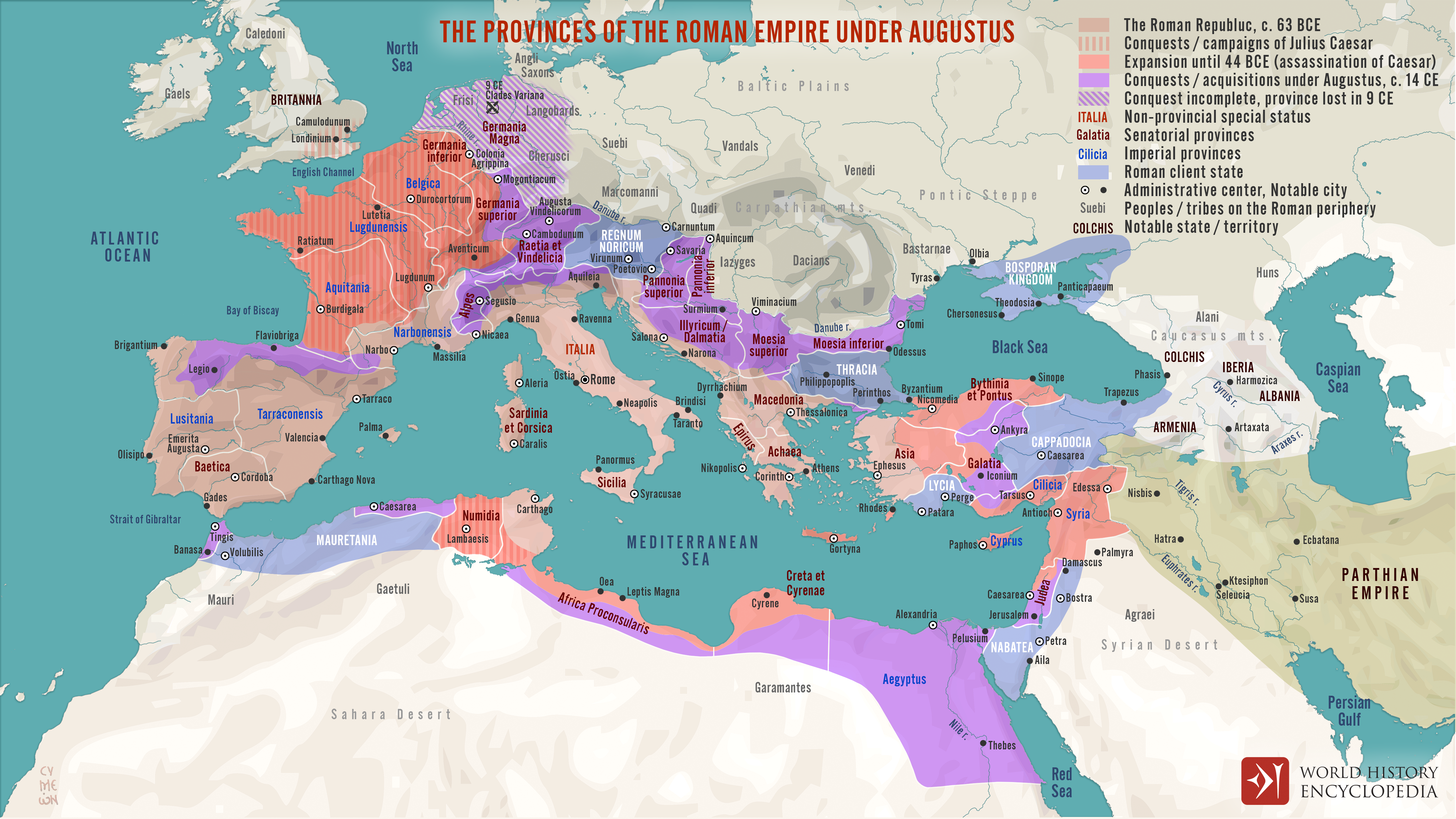
This map illustrates the expansion of the Roman Republic during the military campaigns and conquests of Julius Caesar (100–44 BCE), and its transformation into an empire under the reign of Caesar Augustus (63 BCE–14 CE), also known as Octavian. By the death of Augustus in 14 CE, the Roman world encircled the entire Mediterranean and extended from the North Sea to the Red Sea.
In addition to territorial expansion, the map also depicts the administrative structure of the Roman world at the time. It highlights the division between regions governed directly by the emperor, those administered by the Roman Senate, and others maintained as semi-independent client states. This layered system reflects the political complexity of the early Roman Empire and its blend of republican legacy with imperial authority.