
Browse Content

Image
Map of New France, 1750 CE
A map of New France c. 1750 CE within the context of European colonies...

Image
Map of the United States, 1874
A map of the United States, showing each of its states, published...

Image
Map of the Holy Roman Empire, 1648 CE
Map of the Holy Roman Empire depicting its boundaries following...

Image
Map of the Holy Roman Empire, 972-1032 CE
Map of the Holy Roman Empire depicting its boundaries under the...
Image
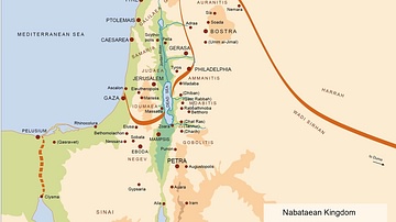
Map of the Nabatean Kingdom
Map of the Nabatean Kingdom at its greatest extent, c. 85 BCE.
Image
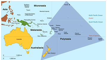
Map of Polynesia
Map showing the Polynesian Triangle and some of its islands.