


Related Images
Image
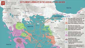
Map of Settlement & Mobility in the Aegean, c. 1100-550 BCE - Migration, Memory, and the Making of the Greek World
The period following the collapse of the Mycenaean palatial system...
Image
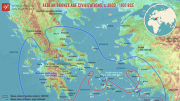
Map of the Aegean Bronze Age Civilizations, c. 3000-1100 BCE - From Minoan Maritime Exchange to Mycenaean Dominance
The Aegean world of the Bronze Age (c. 3000–1100 BCE) was shaped...

Image
Map of the Greek City-states c. 500 BCE
This map illustrates the city-states of Classical Greece around...
Image
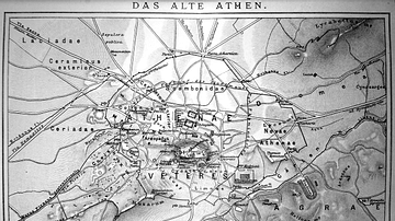
Map of Ancient Athens
A map of ancient Athens (with some text in German).

Image
Map of Greece under Theban Hegemony
A map showing ancient Greece at the time of Theban hegemony, 371...

Image
Map of the Third Intermediate Period
A map showing the political divisions in ancient Egypt during the...
Cite This Work
APA Style
Megistias. (2012, April 26). Map of Archaic Greece. World History Encyclopedia. https://www.worldhistory.org/image/328/map-of-archaic-greece/
Chicago Style
Megistias. "Map of Archaic Greece." World History Encyclopedia, April 26, 2012. https://www.worldhistory.org/image/328/map-of-archaic-greece/.
MLA Style
Megistias. "Map of Archaic Greece." World History Encyclopedia, 26 Apr 2012, https://www.worldhistory.org/image/328/map-of-archaic-greece/.