

This text is available in other languages:

Around c. 1200 BCE, the southern Levant stood at a critical point of transformation following the decline of Late Bronze Age systems. For centuries, Egyptian hegemony under rulers such as Ramesses II (reign 1279–1213 BCE) and his successors had structured the region through a network of Canaanite city-states. By the late 13th and early 12th centuries BCE, this imperial framework weakened, leaving key urban centers, such as Hazor, Megiddo, and Lachish, to persist with varying degrees of autonomy, while Egyptian influence survived only in limited administrative strongholds. At the same time, coastal regions witnessed the arrival and gradual settlement of groups associated with the Sea Peoples migrations, including the Philistines, marking a significant shift in the balance of power along the eastern Mediterranean.
Rather than clearly defined states, the region formed a mosaic of overlapping and fluid zones. Archaeological evidence points to the growth of dispersed highland settlements in the central and southern uplands, often linked in later traditions to early Israelite identity, while the Transjordan remained dominated by fragmented agro-pastoral communities and nomadic groups, including those identified in Egyptian sources as Shasu. In this transitional landscape, older urban systems, emerging rural communities, and mobile populations coexisted, illustrating a gradual and regionally varied transformation that would shape the political and cultural developments of the Early Iron Age.
Special thanks to Patrick Scott Smith, M.A. for his research and input.
About the Author

Related Images

Map of Trade Networks of the Late Bronze Age Mediterranean - Empires, Merchants, and Maritime Routes of the Ancient World
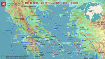
Map of the Aegean Bronze Age Civilizations, c. 3000-1100 BCE - From Minoan Maritime Exchange to Mycenaean Dominance

Bronze Age Mediterranean Invasions & Migrations

Map of the Late Bronze Age Collapse and Transfromation - Interconnected political, economic & environmental breakdown

Map of India in the Vedic Age, 1500 BCE-500 BCE - Indo-Aryan Cultures in Northern India

Some Active Trade Routes in the Bronze Age Mediterranean
Cite This Work
APA Style
Netchev, S. (2026, April 29). Map of Southern Levant c.1200 BCE: Emerging Societies in the Early Iron Age. World History Encyclopedia. https://www.worldhistory.org/image/21764/map-of-southern-levant-c1200-bce/
Chicago Style
Netchev, Simeon. "Map of Southern Levant c.1200 BCE: Emerging Societies in the Early Iron Age." World History Encyclopedia, April 29, 2026. https://www.worldhistory.org/image/21764/map-of-southern-levant-c1200-bce/.
MLA Style
Netchev, Simeon. "Map of Southern Levant c.1200 BCE: Emerging Societies in the Early Iron Age." World History Encyclopedia, 29 Apr 2026, https://www.worldhistory.org/image/21764/map-of-southern-levant-c1200-bce/.