


The Allied landings in Normandy on 6 June 1944, commonly known as D-Day, marked one of the most significant operations of the Second World War (1939-1945) and the largest amphibious invasion in military history. As the opening phase of Operation Overlord, the invasion sought to establish a permanent Allied foothold in German-occupied Western Europe and create the conditions for the liberation of France. Forces from the United States, United Kingdom, Canada, and numerous Allied nations crossed the English Channel and assaulted five designated landing beaches, Utah, Omaha, Gold, Juno, and Sword, supported by extensive naval, airborne, and air operations. The success of the landings reflected years of planning, logistical preparation, intelligence gathering, and multinational coordination.
Despite strong resistance from German forces under Adolf Hitler (rule 1933-1945) and the extensive fortifications of the Atlantic Wall, Allied troops secured critical beachheads and gradually expanded their position in Normandy. The campaign that followed culminated in the liberation of Paris in August 1944 and opened a major Western Front against Nazi Germany. D-Day did not end the war, but it fundamentally altered the strategic balance in Europe by forcing Germany to fight a sustained two-front conflict. As a result, the Normandy landings are widely regarded as a decisive turning point in the defeat of Nazi Germany and the liberation of Western Europe.
About the Author

Related Images

Map of the Western Front in World War I, 1914-1918

Map of Operation Barbarossa, Nazi Germany’s Invasion of USSR - World War II’s decisive 1941 campaign in the East

Trench Warfare on WWI's Western Front, 1914-18

Map of WWII North Africa Campaign, 1940-1943
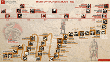
The Rise of Nazi Germany, 1919 - 1939

Map of the World War I in Europe, May 1917
External Links
Cite This Work
APA Style
Netchev, S. (2024, May 22). Map of The D-Day and the Normandy Landings, June 1944: Operation Overlord & History's Largest Amphibious Invasion. World History Encyclopedia. https://www.worldhistory.org/image/18983/map-of-the-d-day-and-the-normandy-landings-june-19/
Chicago Style
Netchev, Simeon. "Map of The D-Day and the Normandy Landings, June 1944: Operation Overlord & History's Largest Amphibious Invasion." World History Encyclopedia, May 22, 2024. https://www.worldhistory.org/image/18983/map-of-the-d-day-and-the-normandy-landings-june-19/.
MLA Style
Netchev, Simeon. "Map of The D-Day and the Normandy Landings, June 1944: Operation Overlord & History's Largest Amphibious Invasion." World History Encyclopedia, 22 May 2024, https://www.worldhistory.org/image/18983/map-of-the-d-day-and-the-normandy-landings-june-19/.