

 2
2
This text is available in other languages:

Roman Hispania under Hadrian (reign 117–138 CE) represented the outcome of a long and often violent process of conquest, beginning during the Second Punic War (218–201 BCE) and concluding with the Cantabrian Wars (29–19 BCE). By c. 125 CE, the peninsula was governed through three principal provinces: the imperial provinces of Tarraconensis and Lusitania and the senatorial province of Baetica. Provincial capitals, judicial districts, military installations, and road networks connected local communities to Roman administrative authority while facilitating taxation, troop movement, migration, and the circulation of metals, olive oil, wine, grain, and other commodities across the empire.
Roman rule did not erase the peninsula’s cultural diversity but created an uneven process of political integration and cultural exchange. Cities such as Tarraco, Emerita Augusta, Corduba, and Italica became centres of government, commerce, public religion, and civic identity, while Latin, Roman law, and imperial institutions interacted with enduring regional traditions. Hispania’s importance within the wider Mediterranean is reflected in its economic resources, urban development, and the emergence of emperors including Trajan (reign 98–117 CE) and Hadrian (reign 117–138 CE). By Hadrian’s reign, Hispania was not a distant frontier but a deeply connected component of the Roman imperial system.
About the Author
Related Images
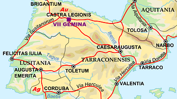
Map of the Iberian Penninsula in 125 AD

Map of the Hadrian’s First Imperial Tour, 121–125 CE - Frontier Inspection, Hadrian’s Wall and Provincial Rule

The Iberian Peninsula, c. 1000 CE

Map of the Roman Empire in 125 CE

Map of Emperor Hadrian’s 4 Journeys Across the Roman Empire - Frontiers, Diplomacy & Imperial Power, 117–133 CE
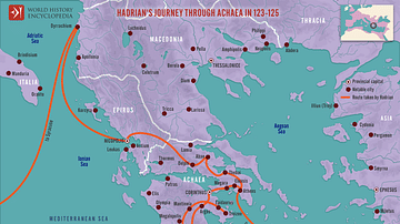
Hadrian's Journey through Achaea, 123-125
Cite This Work
APA Style
Netchev, S. (2026, July 24). Map of Roman Hispania under Hadrian, c. 125 CE: Administration and Urban Networks in the Iberian Peninsula. World History Encyclopedia. https://www.worldhistory.org/image/16928/map-of-roman-hispania-under-hadrian-c-125-ce/
Chicago Style
Netchev, Simeon. "Map of Roman Hispania under Hadrian, c. 125 CE: Administration and Urban Networks in the Iberian Peninsula." World History Encyclopedia, July 24, 2026. https://www.worldhistory.org/image/16928/map-of-roman-hispania-under-hadrian-c-125-ce/.
MLA Style
Netchev, Simeon. "Map of Roman Hispania under Hadrian, c. 125 CE: Administration and Urban Networks in the Iberian Peninsula." World History Encyclopedia, 24 Jul 2026, https://www.worldhistory.org/image/16928/map-of-roman-hispania-under-hadrian-c-125-ce/.
