

This text is available in other languages:

This map illustrates the shifting frontiers of the Byzantine Empire from the accession of Justinian I (reign circa 527 - 565) to the Fourth Crusade's sack of Constantinople in 1204, showing how the Greek-speaking eastern Roman state acted as both a military bulwark and a cultural bridge between medieval Europe and the Muslim world.
Justinian’s armies briefly restored Roman Mediterranean unity, but later centuries saw losses to Slavs, Bulgars, and successive Muslim caliphates. A revival peaked under Basil II (reign circa 976 - 1025), who crushed Bulgaria and expanded into Armenia, yet civil strife, the Seljuk victory at Manzikert (1071), and Venetian economic leverage eroded Byzantine strength. In 1204 a Venice-backed Fourth Crusade toppled Constantinople, replacing Byzantine rule with the Latin Empire and splintering the remnants into successor states—Nicaea, Epirus, and Trebizond.
About the Author

Related Images

Map of the Latin Empire: A Crusader State in Constantinople - Imperium Romaniae and the Fragmentation of Byzantium

Map of Odysseus’ 10-year Journey Home

Map of Byzantine Constantinople

Map of the First Crusade, 1096 - 1099
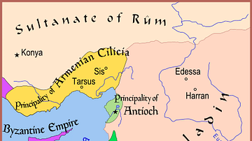
Map of The Latin East, 1190 CE

Map of Europe Before the Fall of Constantinople, c. 1450
Cite This Work
APA Style
Netchev, S. (2022, March 09). Map of the Byzantine Empire, c.520 - 1204. World History Encyclopedia. https://www.worldhistory.org/image/15330/map-of-the-byzantine-empire-c520---1204/
Chicago Style
Netchev, Simeon. "Map of the Byzantine Empire, c.520 - 1204." World History Encyclopedia, March 09, 2022. https://www.worldhistory.org/image/15330/map-of-the-byzantine-empire-c520---1204/.
MLA Style
Netchev, Simeon. "Map of the Byzantine Empire, c.520 - 1204." World History Encyclopedia, 09 Mar 2022, https://www.worldhistory.org/image/15330/map-of-the-byzantine-empire-c520---1204/.