
Server Costs Fundraiser 2026

This text is available in other languages:

The key locations, kingdoms, and heroes associated with Homer’s Iliad form a cultural map of the Late Bronze Age Aegean world. Composed in the 8th century BCE and set in the final year of the war between the Achaean coalition and the city of Troy, the epic reflects a remembered landscape of Mycenaean power, linking rulers such as Agamemnon of Mycenae, Nestor of Pylos, Menelaus of Sparta, and Odysseus of Ithaca to a broader network of allied Greek forces who sailed to western Anatolia. Although the poem is not a historical record, it preserves political relationships, maritime connections, and heroic genealogies that echo the structures of Bronze Age society.
The Trojan War itself is traditionally placed by ancient chronographers between c. 1330-1135 BCE, a period that coincides with the wider collapse of Bronze Age civilizations around the eastern Mediterranean. While the historicity of the conflict remains debated, archaeological work at Hisarlik (identified as ancient Troy) reveals multiple destruction layers that align with the era described by Homer. As a result, the Iliad is best understood as a blend of myth, memory, and historical resonance, an epic that captures the cultural imagination of early Greece while offering glimpses into the geopolitical realities of the Late Bronze Age world.
About the Author

Related Images

Map of the Battlefield of the Trojan War c. 1200 BCE - Landscape of the Iliad
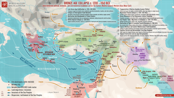
Map of the Late Bronze Age Collapse c. 1200 - 1150 BCE

Map of the Trojan War States, c. 1200 BCE
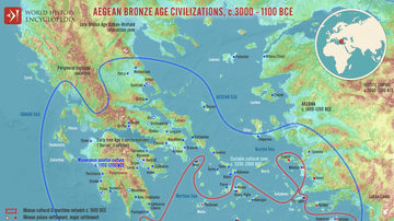
Map of the Aegean Bronze Age Civilizations, c. 3000-1100 BCE - From Minoan Maritime Exchange to Mycenaean Dominance

Map of Odysseus’ 10-year Journey Home
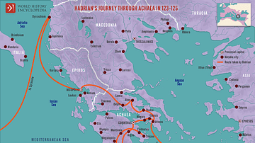
Hadrian's Journey through Achaea, 123-125
Cite This Work
APA Style
Netchev, S. (2025, November 29). Map of the World of the Iliad, c. 1200 BCE. World History Encyclopedia. https://www.worldhistory.org/image/15242/map-of-the-world-of-the-iliad-c-1200-bce/
Chicago Style
Netchev, Simeon. "Map of the World of the Iliad, c. 1200 BCE." World History Encyclopedia, November 29, 2025. https://www.worldhistory.org/image/15242/map-of-the-world-of-the-iliad-c-1200-bce/.
MLA Style
Netchev, Simeon. "Map of the World of the Iliad, c. 1200 BCE." World History Encyclopedia, 29 Nov 2025, https://www.worldhistory.org/image/15242/map-of-the-world-of-the-iliad-c-1200-bce/.